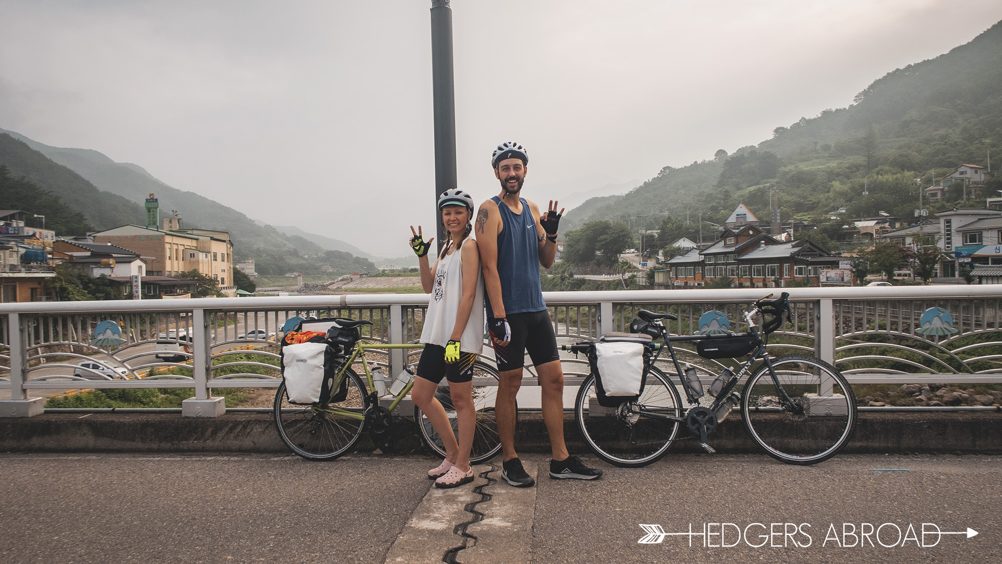
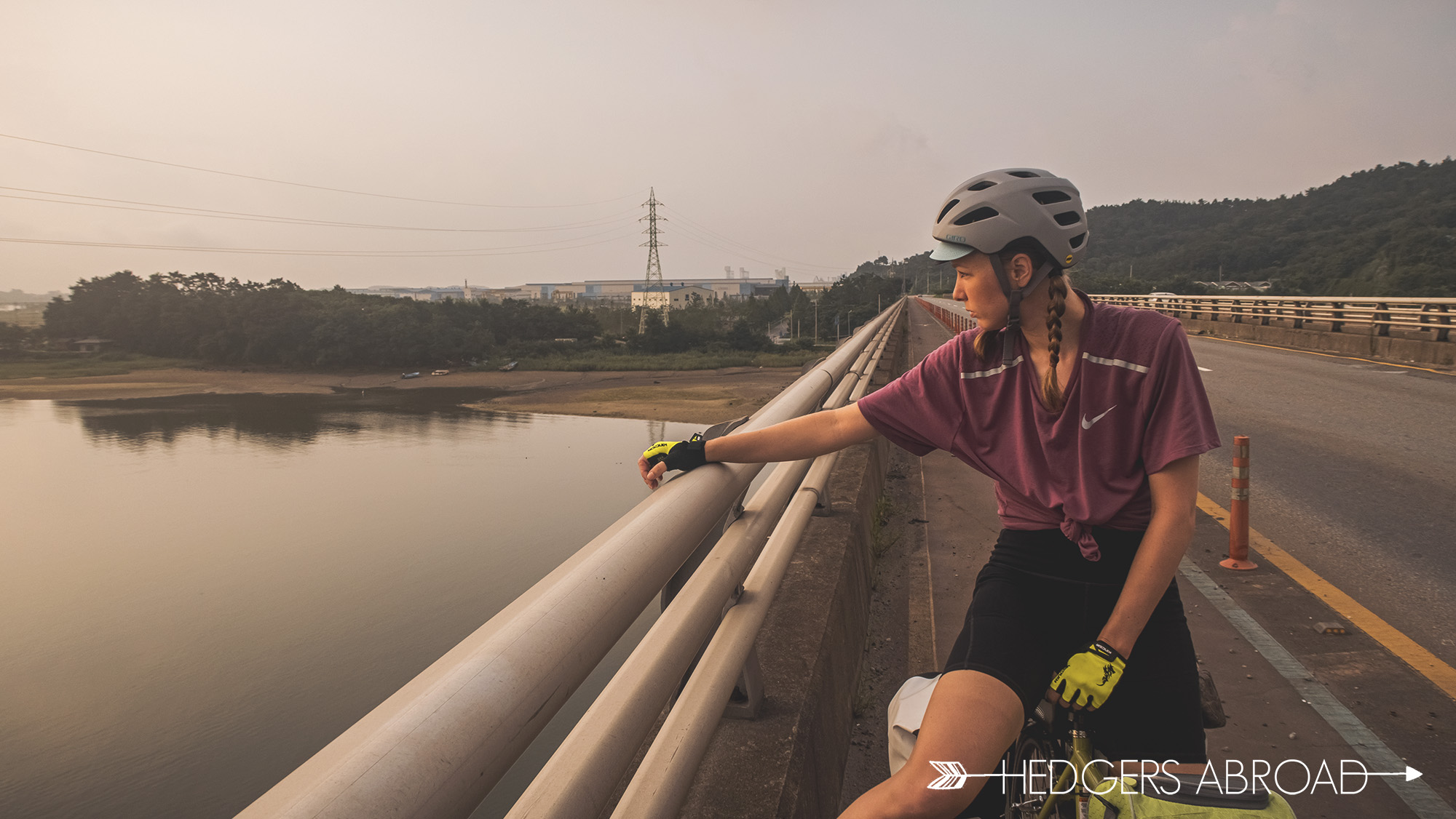
The idea of a vacation during the COVID-19 pandemic seemed a daunting and very limited prospect, but we are determined to have the best 2020 we’re allowed! With social distancing in mind, we decided to pack our bags, load them onto our new bicycles, and bike the 155km Seomjin River Bike Trail twice! This area of Korea has always been one of our personal favorites, so experiencing its natural beauty on a bicycle seemed a no-brainer. Though we’re not currently able to travel outside of Korea, this journey turned into an amazing experience despite our follies and the threat of nature’s fury.
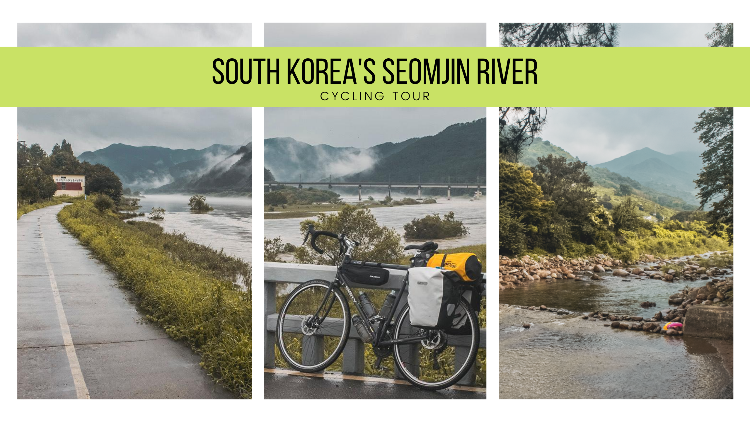
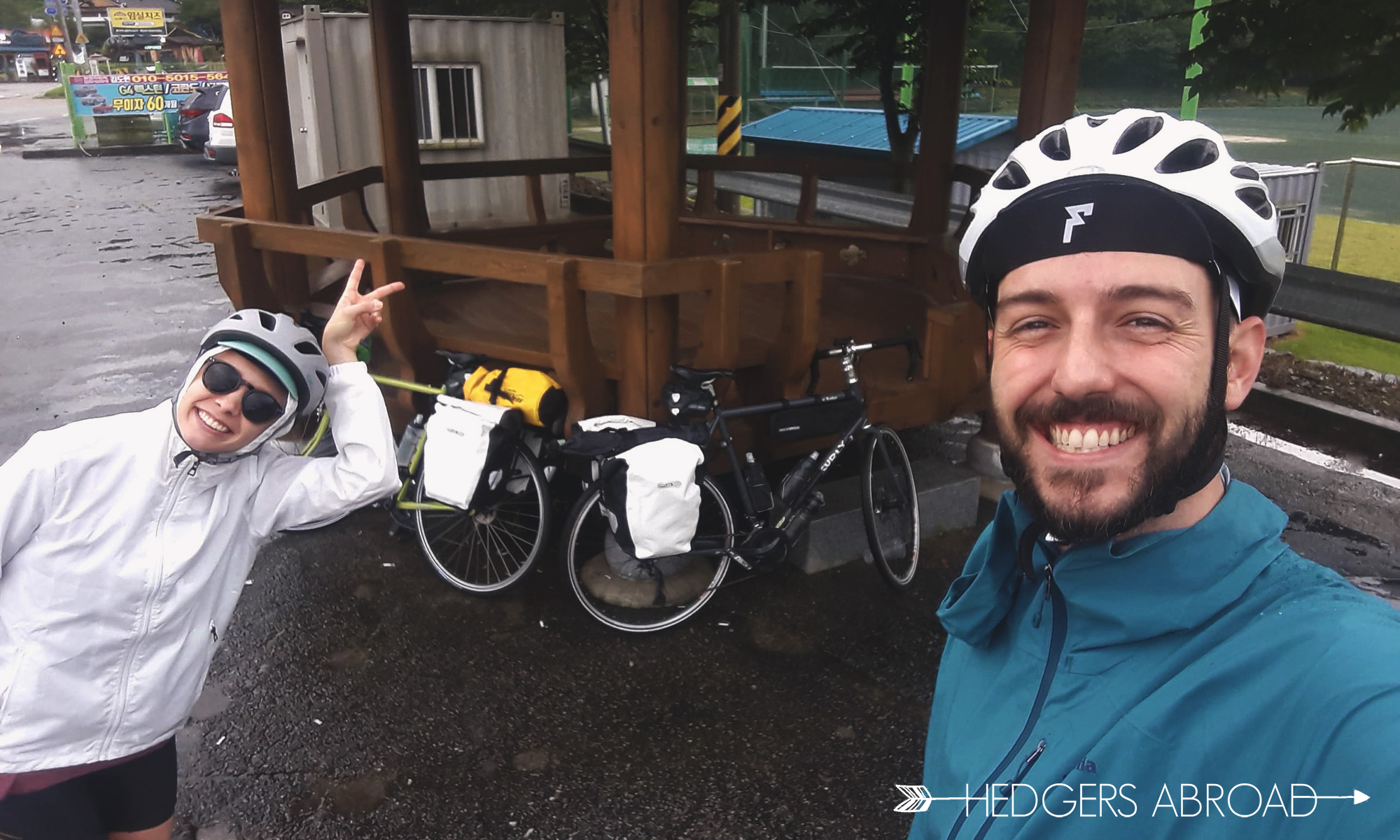
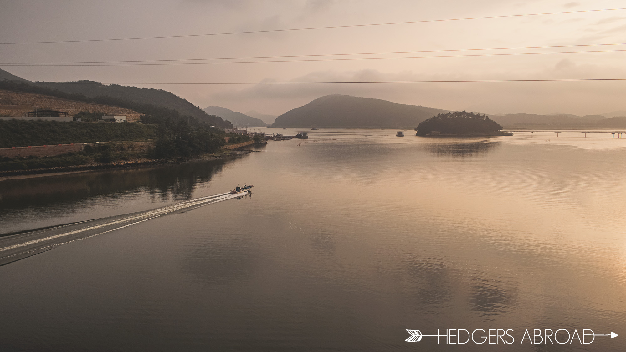
With a week off from school, we set an easy pace for six straight days. What we’d counted on for nature was the stunning mountains, lush forests, sprawling valleys, and a beautiful river. What we got was record setting rainfall, detours caused by flooded bridges, and the constant question of “at what point should we leave for safety reasons?” Thankfully, we managed to barely miss the worst of the flooding and, although wet, we had an excellent time in this area skirting Jirisan National Park.
Here is our journey. You can find maps Stephanie has created for points of interest along our route at the bottom. There, you can also see pictures of the devastation from the floods that we missed by mere hours.
Day 1
Gangjinmyeon Sports Park – Gokseong
62 km
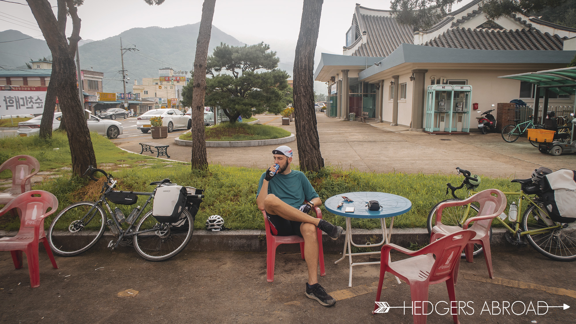
Finding the start of the bike trail was a little confusing from information online. The map of the trail said that the start was in Gangjinmyeon (강진면), but other people listed it as the Seomjingang Dam. We decided to start at the sports park as there is an adequate parking lot for cars and the first stamp booth is located here. We have since discovered that the dam is the actual starting point of the trail. Womp.
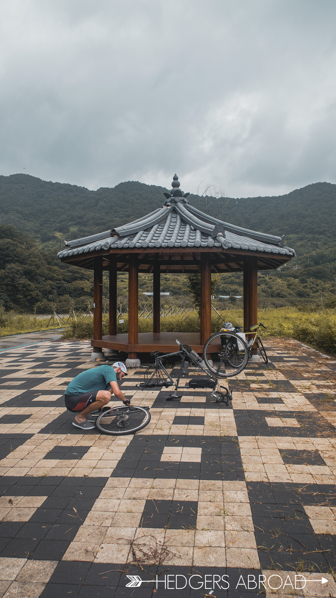
Driving there, we had no rain and sunny skies, but as soon as we got into the mountains, it promptly started dumping on us. We waited a while and decided we just needed to go for it, starting later than expected at nine in the morning. The river looked high, but that was normal for the rainy season. The high river had flooded two bridges which were abnormally low lying to begin with. We had to backtrack and then detour over a small mountain farming village, adding 6 kilometers to our trip. We huffed and puffed to the top of the mountain and, catching our breath, decided to take a short break for some water. Ryan leaned his bike against a pole, but he didn’t notice the little bush that he was up against. Saddling up to go down the backside of the mountain, we soon heard air escaping from his tire. The “unpopable tire” had a thorn in the sidewall and Ryan had already gotten a flat, only 12 km into our first day. Sidewalls are weak and thorns are sharp: lessons learned.
The late start, rain, and detours had us cycling well past the hottest and most humid part of the day. We tried to make a push for the finish but ended up getting pretty tired and hungry. When we pulled into Gokseong, it was 2:30 in the afternoon. The hotel was fairly far away from the city center, so we ordered delivery chicken, washed our clothes, and crashed. Bad hotel, less-than-perfect first day, exhausted, but extremely happy with a belly full of chicken and CSI on the television.
Refueling
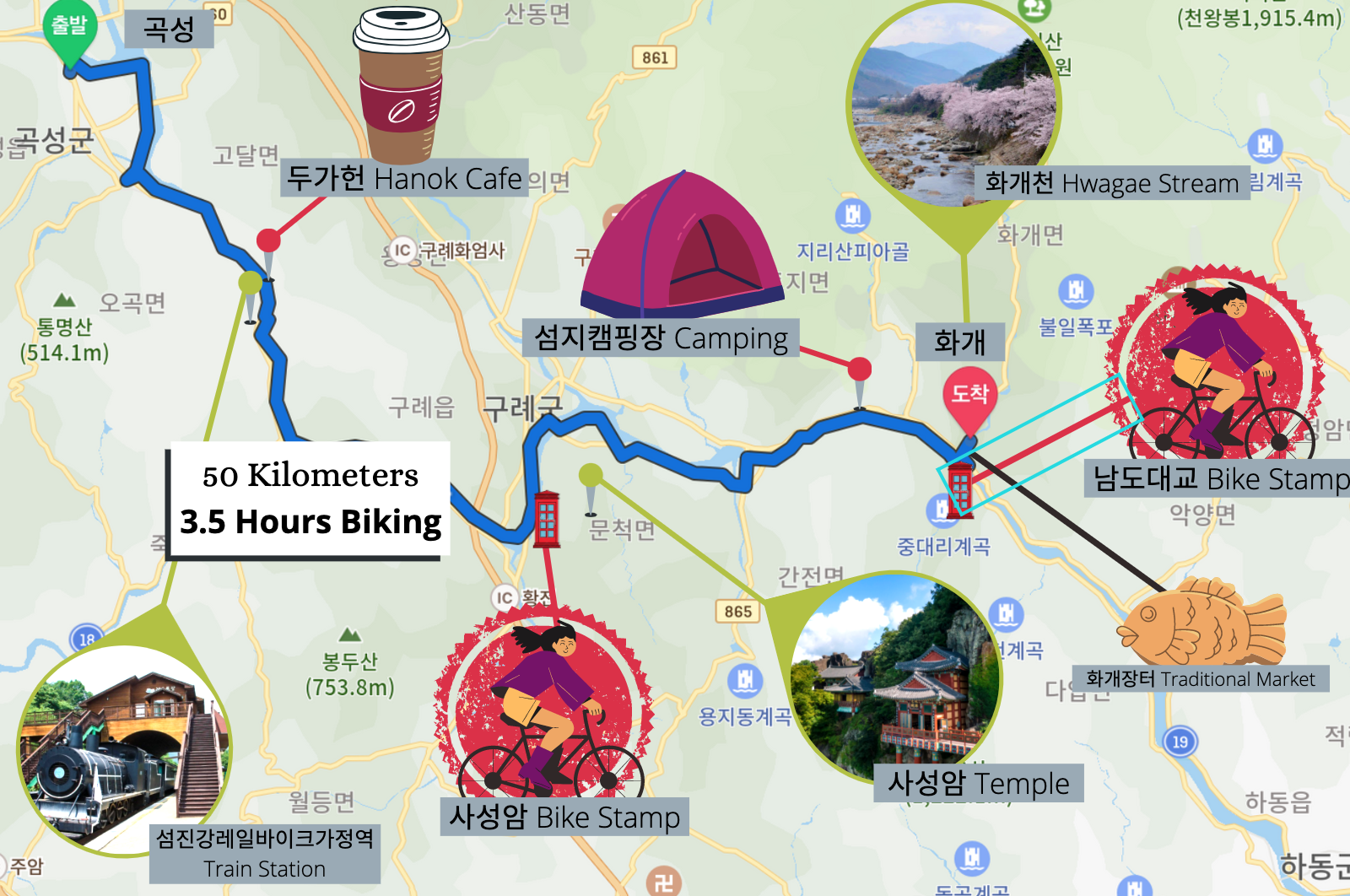
Day 2
Gokseong – Hwagae
52 km
We knew we needed to get an earlier start, regardless of weather, so we got ready and out the door by 6:30am. We headed to where our bikes were locked up, only to find Ryan’s bike had been backed into by a truck! The frame was dented, handlebars and rear bike rack bent, and gears were out of place and jumping off the cassette. We called the owner of the hotel, rousing him from sleep, asking to see the CCTV to see who had been responsible. Through our broken Korean, we came to find out it was HE who had been the culprit, and was trying his hardest not to fully admit it. It was beyond frustrating that he hadn’t immediately told us about it, but ultimately we knew our decision to lock up the bikes in the parking area, out of the rain, was why this situation had happened. Never again. We bent the rack into a fairly straight orientation and handlebars back the best we could and set out down the road, hoping the bike was okay to ride and no further problems would arise. Frame integrity be damned!
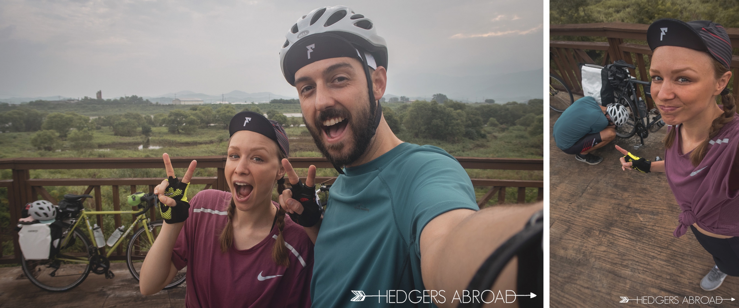
Try to remain positive after the car accident
Checking for directions outside of Gurye Train Station
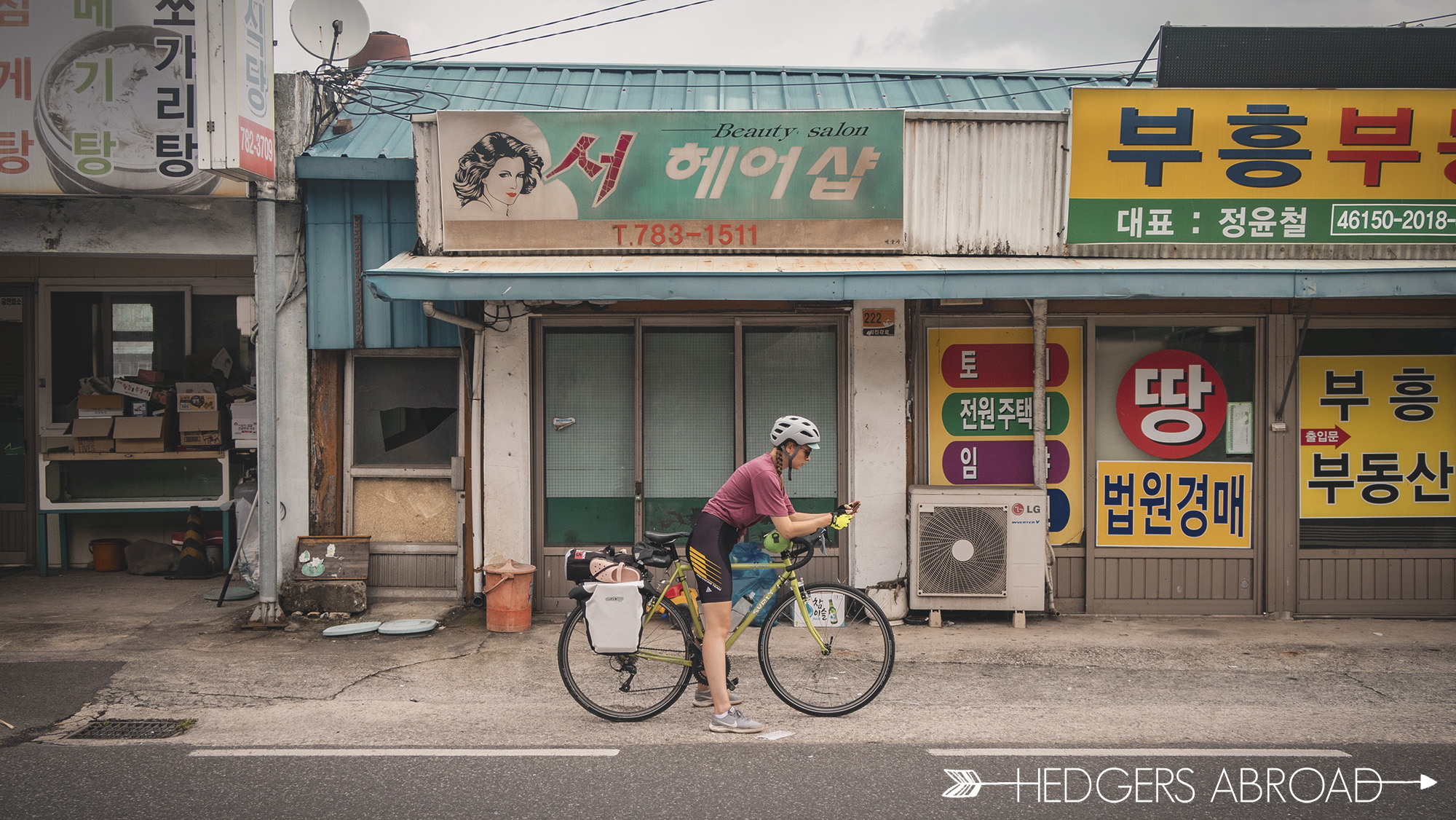
The rain had stopped and once in Gurye county, the bike trail departed the river path and continued along the deserted early morning roads. It was mostly downhill and shaded so the riding was especially easy. We felt so good about the progress, we stopped for coffee at the 두가헌 Hanok Cafe for a while. It has beautiful views looking out across the river, and after sitting and relaxing for a while, we decided that stopping more often would be good for morale. No more powering through to our destination! Caffeinated and feeling a bit better about the morning events, we rode the rest of the way at our leisure towards Hwagae. Full disclosure, though; our #partypace on downhill pavement is nearly 50% faster than on trails for the same effort, so we flew.
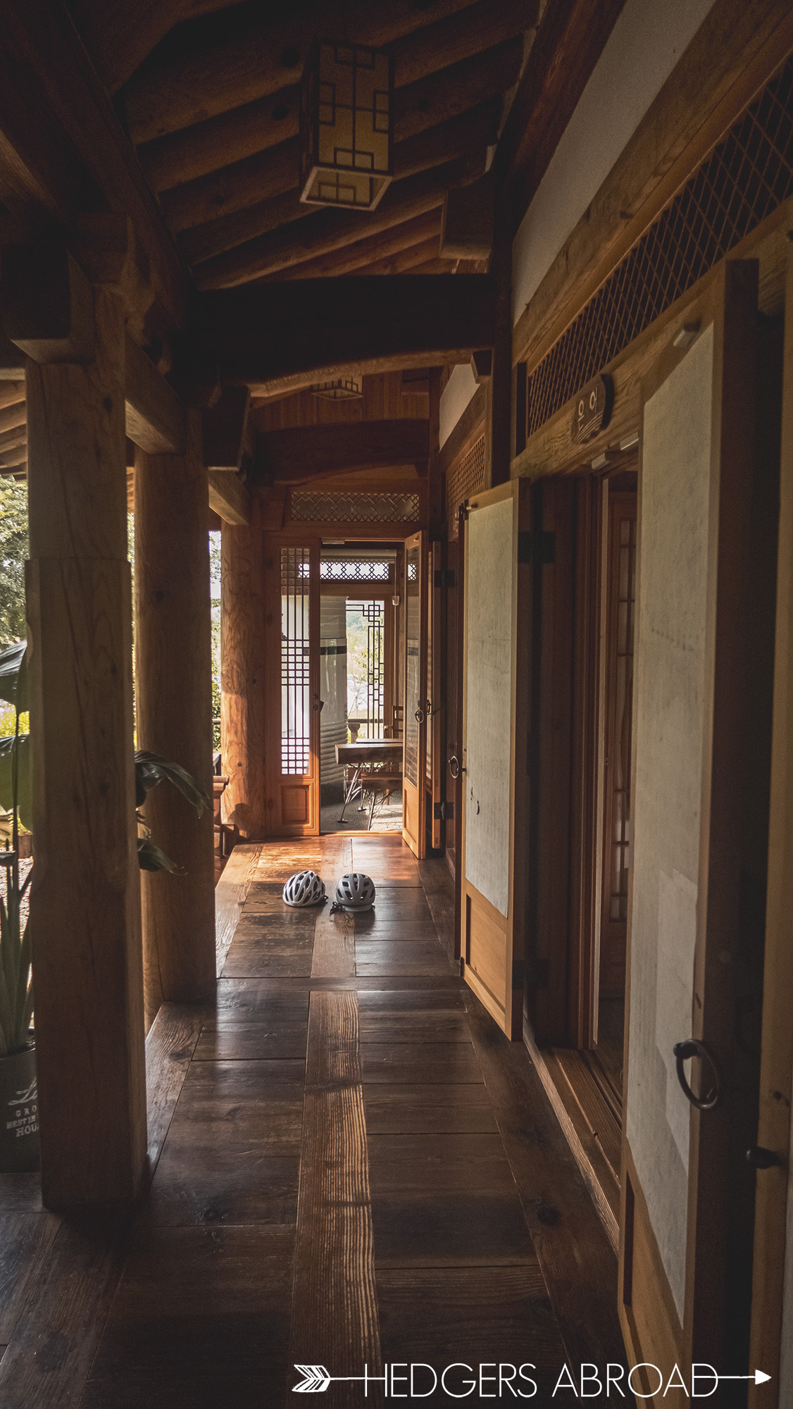
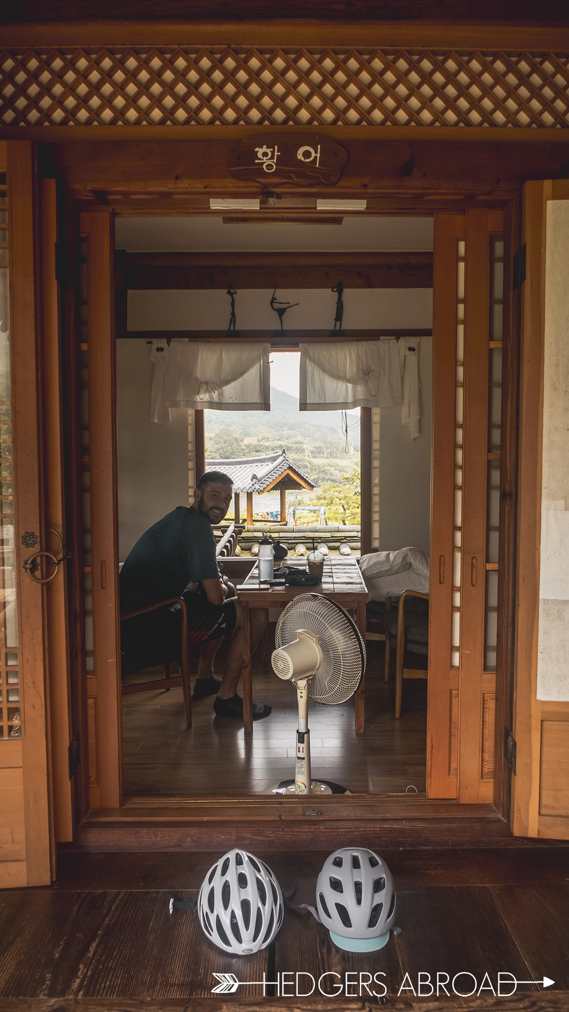
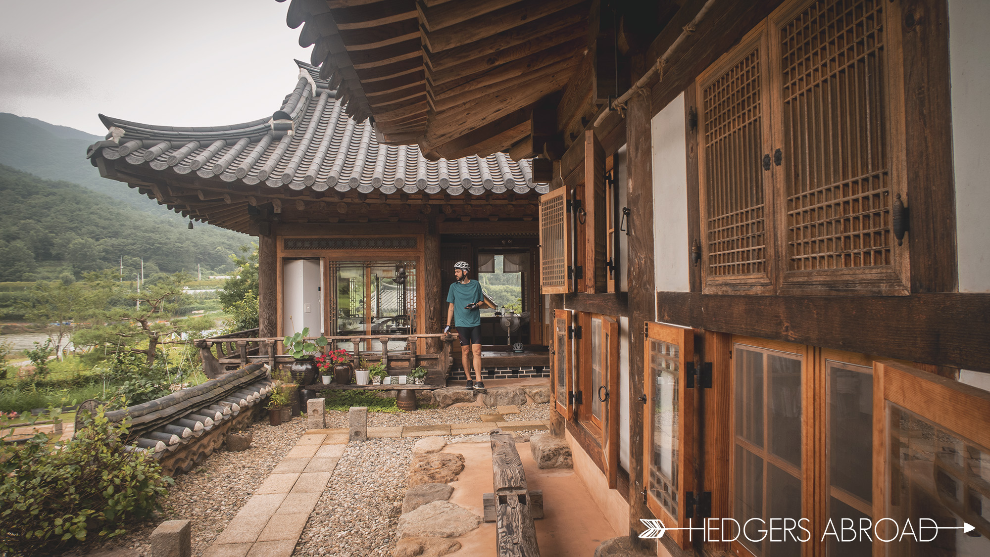
Dugahyeon Hanok House Cafe and Pension
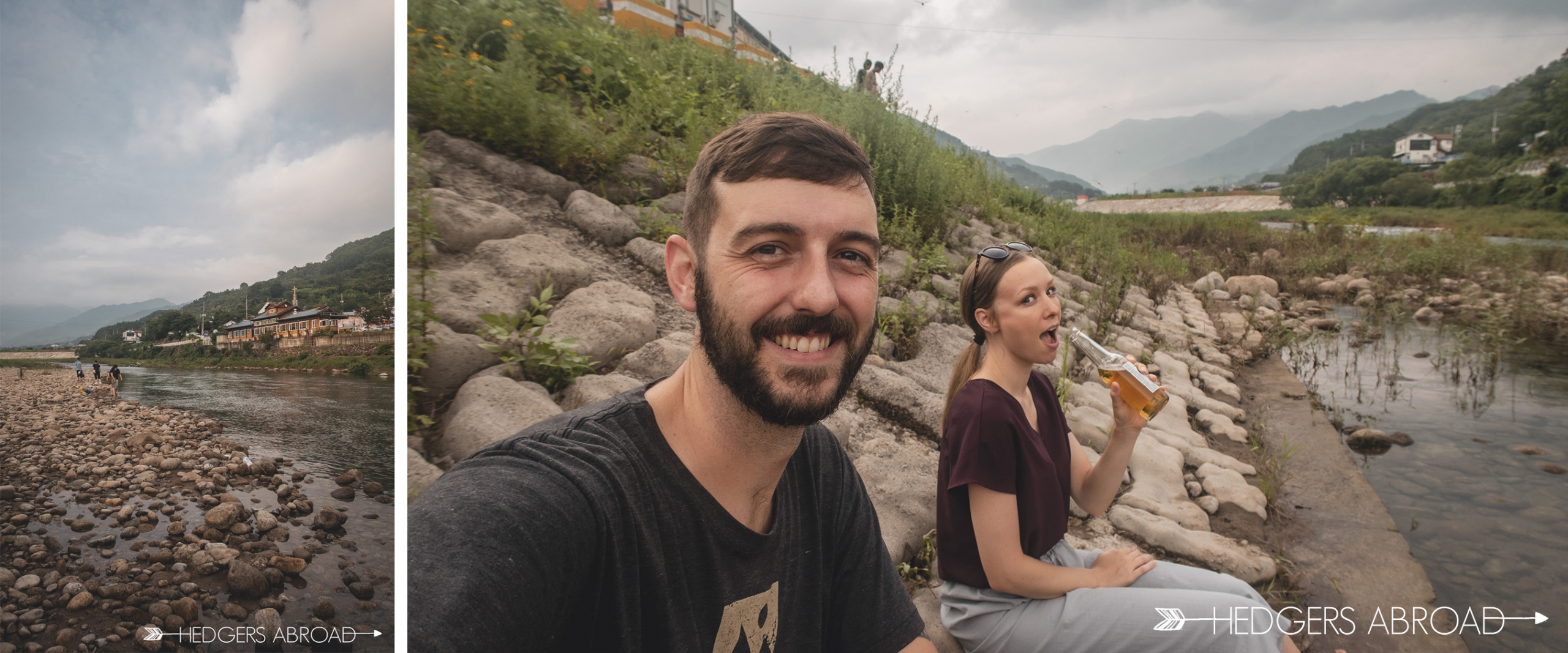
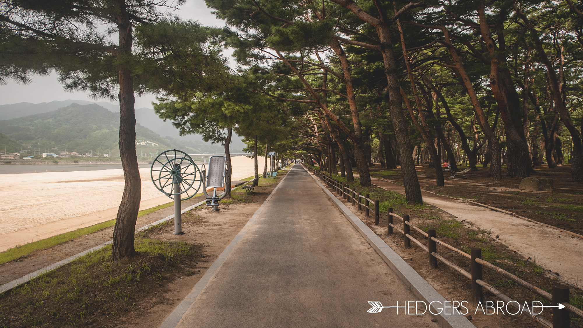
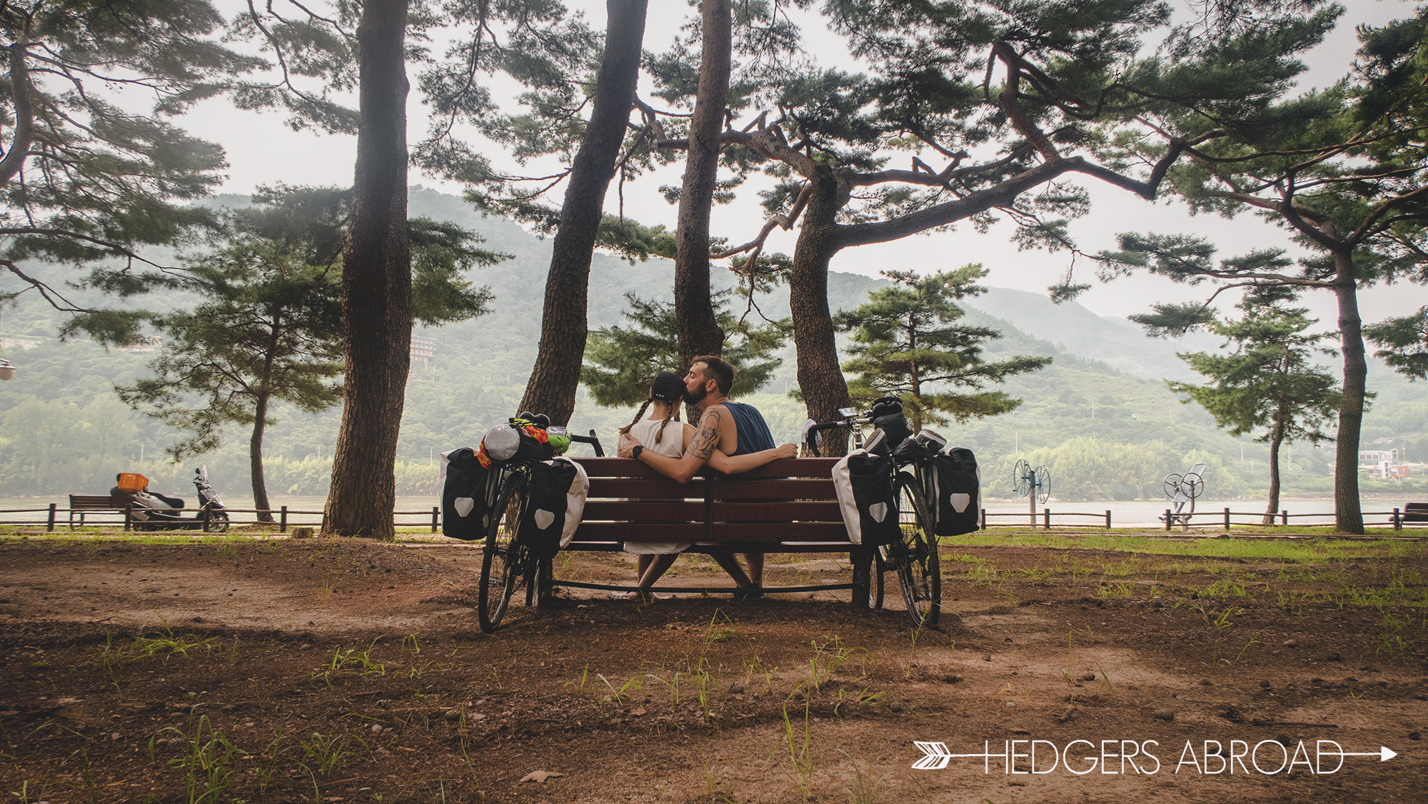
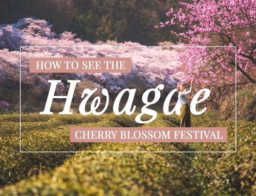
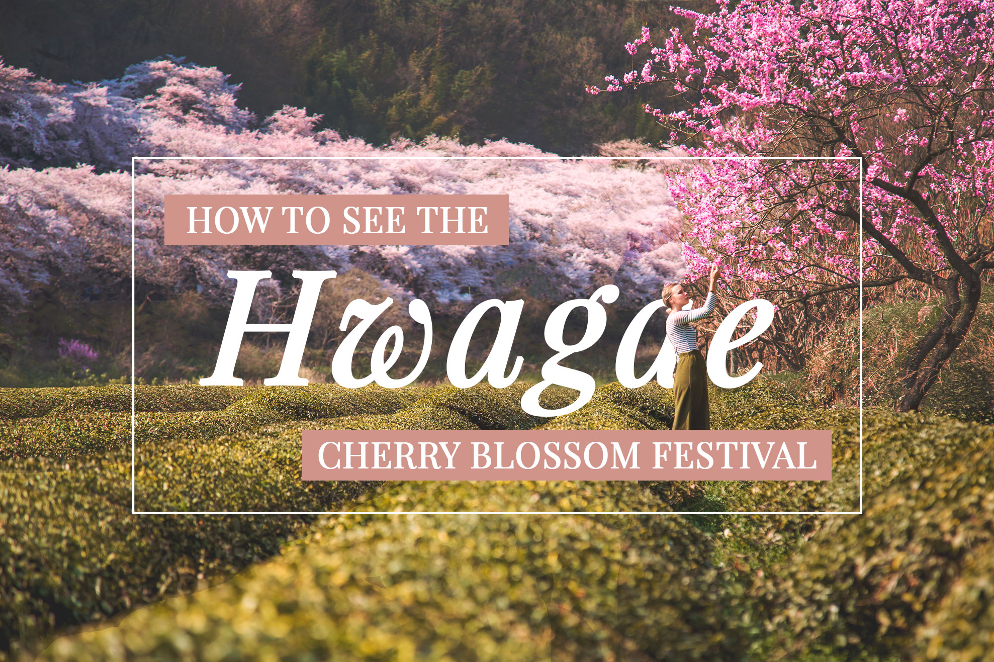
If you have never been to Hwagae, go. It is one of our favorite Jirisan Mountain valley villages to get away to, in any season. The small town shop owners are the nicest people, quick to smile, and always welcoming. The stream is the perfect setting for a picnic and to cool off in the summertime. In the spring, the roads are lined with hundreds of mature cherry blossoms, a sight that is simply stunning. We arrived in Hwagae, taking only three hours flat with the smooth, downhill road riding. It felt like getting home and we promptly found our favorite local jeon and makgeolli restaurant and then spent some time down by the river with our feet in the cool waters.
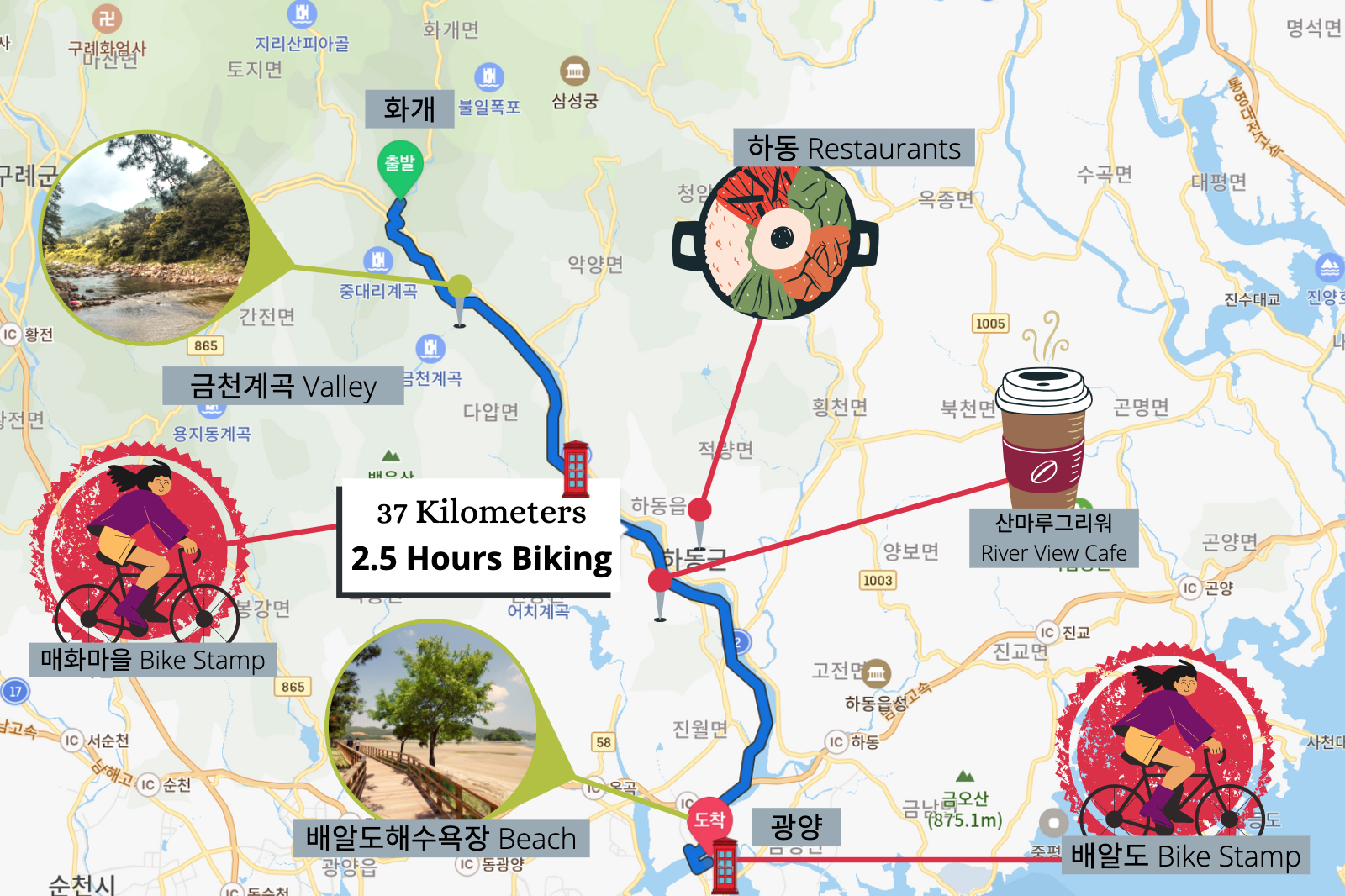
Day 3
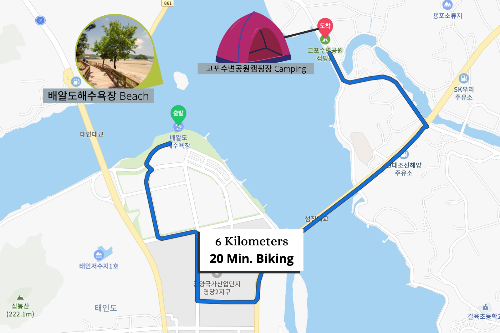
Hwagae – Baeal Beach in Gwangyang
37km +6km to the campsite
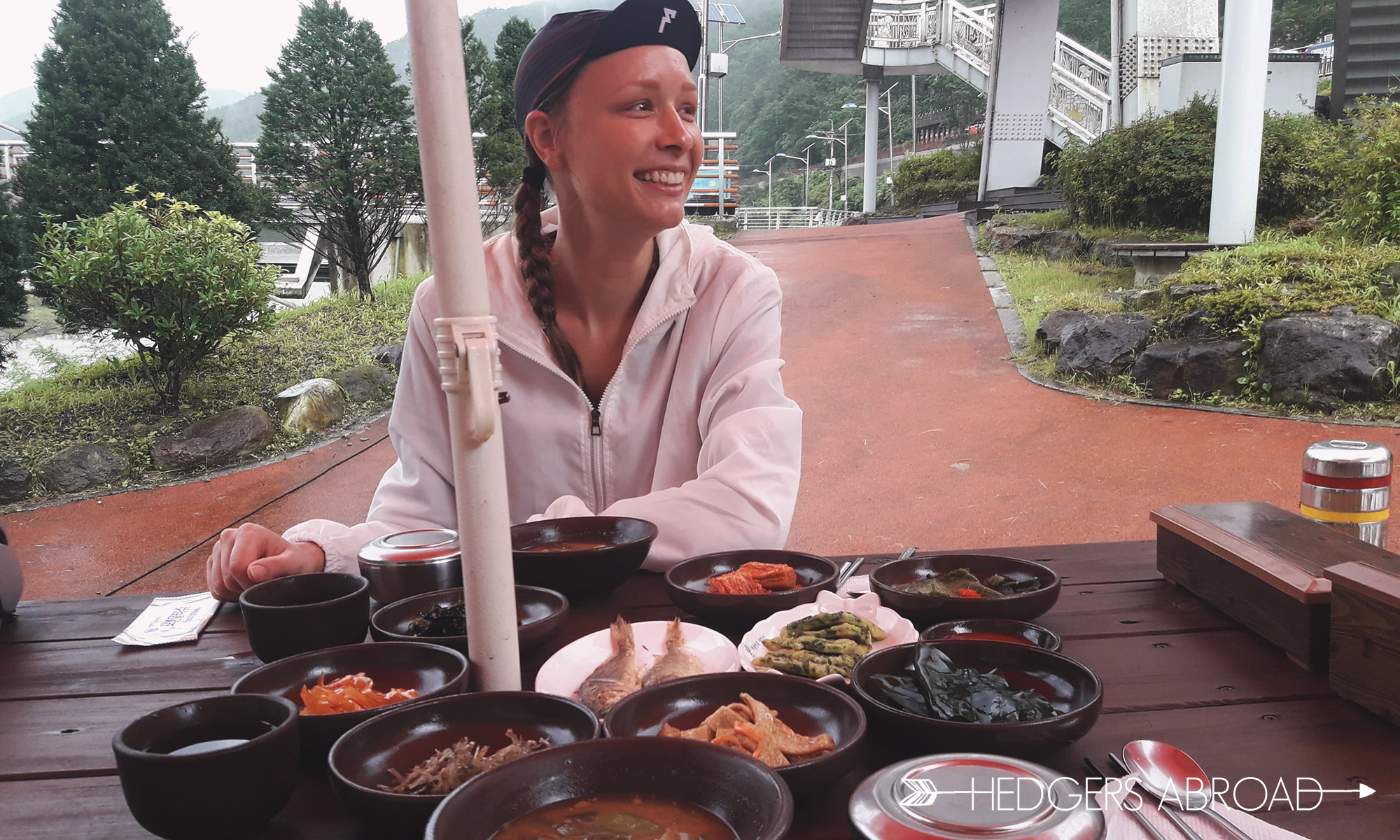
Another beautiful and rain free day greeted us in the morning. We thought this day would be short and easy to the beach, but when researching where we could have lunch/dinner around our destination, Naver told us nothing was in the area. We decided we should stop in Hadong for lunch and buy some stuff for making dinner at our campsite. That meant riding through the hottest part of the day, which meant a lot of sunscreen and shaded snack stops to help us make it through. Hadong has a lot of Korean style restaurants, but we had our eyes set on a new pizza shop that had opened up. The pizza dough was made of rice flour, which is actually pretty tasty. The obligatory Korean corn was still present on our veggie pie, though. Can’t have it all, I guess…
Hadong Riverfront Park
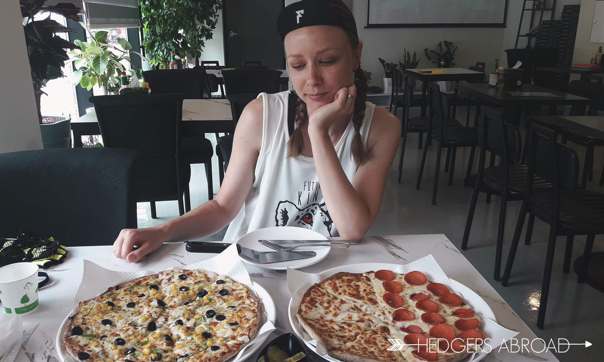
Happy for two giant pizzas, disappointed in corn.
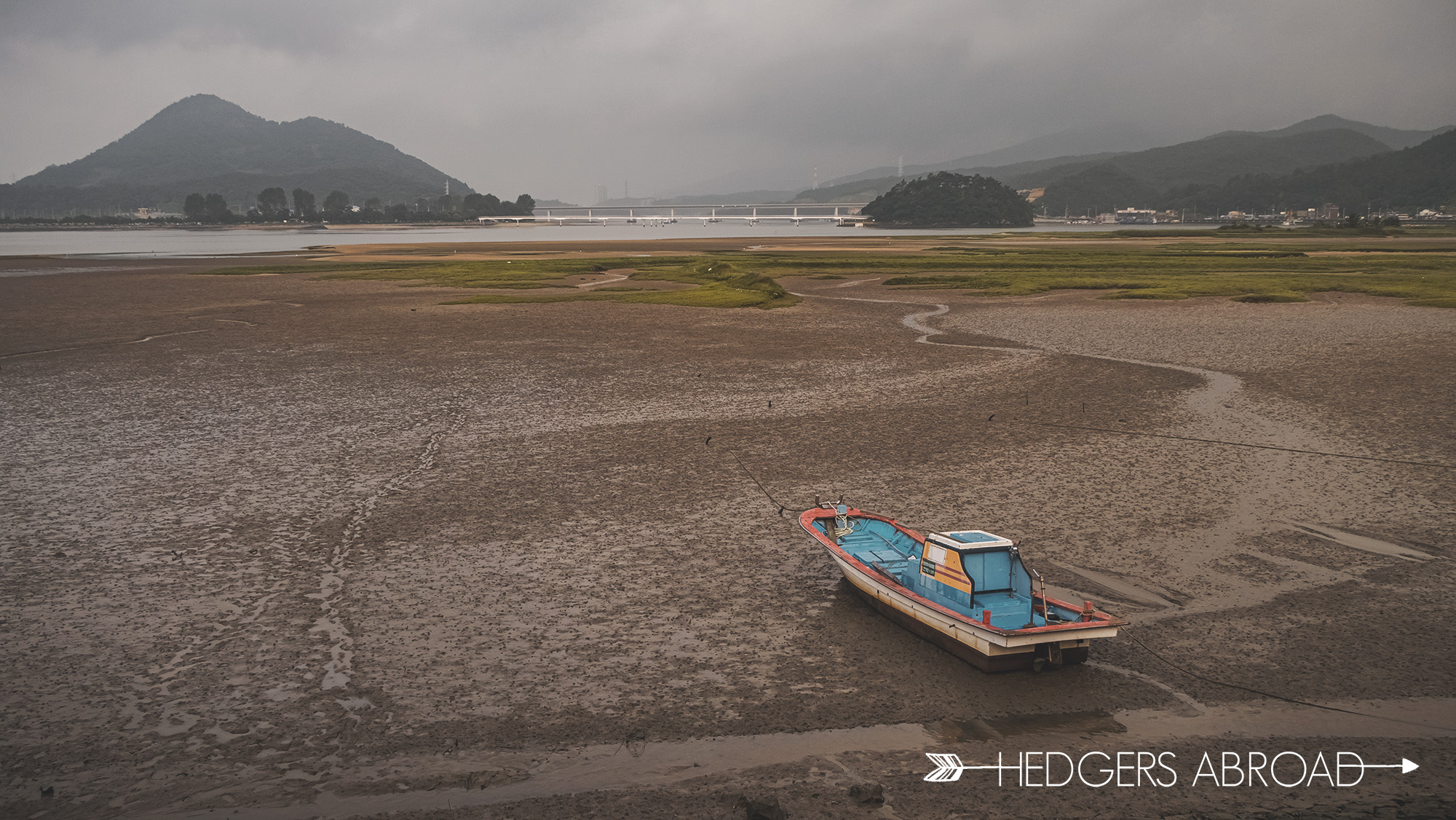
When we neared the 배알도해수욕장 beach, we saw that there were actually quite a few restaurants in the area, though most of them were seafood. We also noticed a few of them served bibimbap as well. If you are doing this route, you can easily find some food in the area near the docks before you cross the bridge to get to the beach.
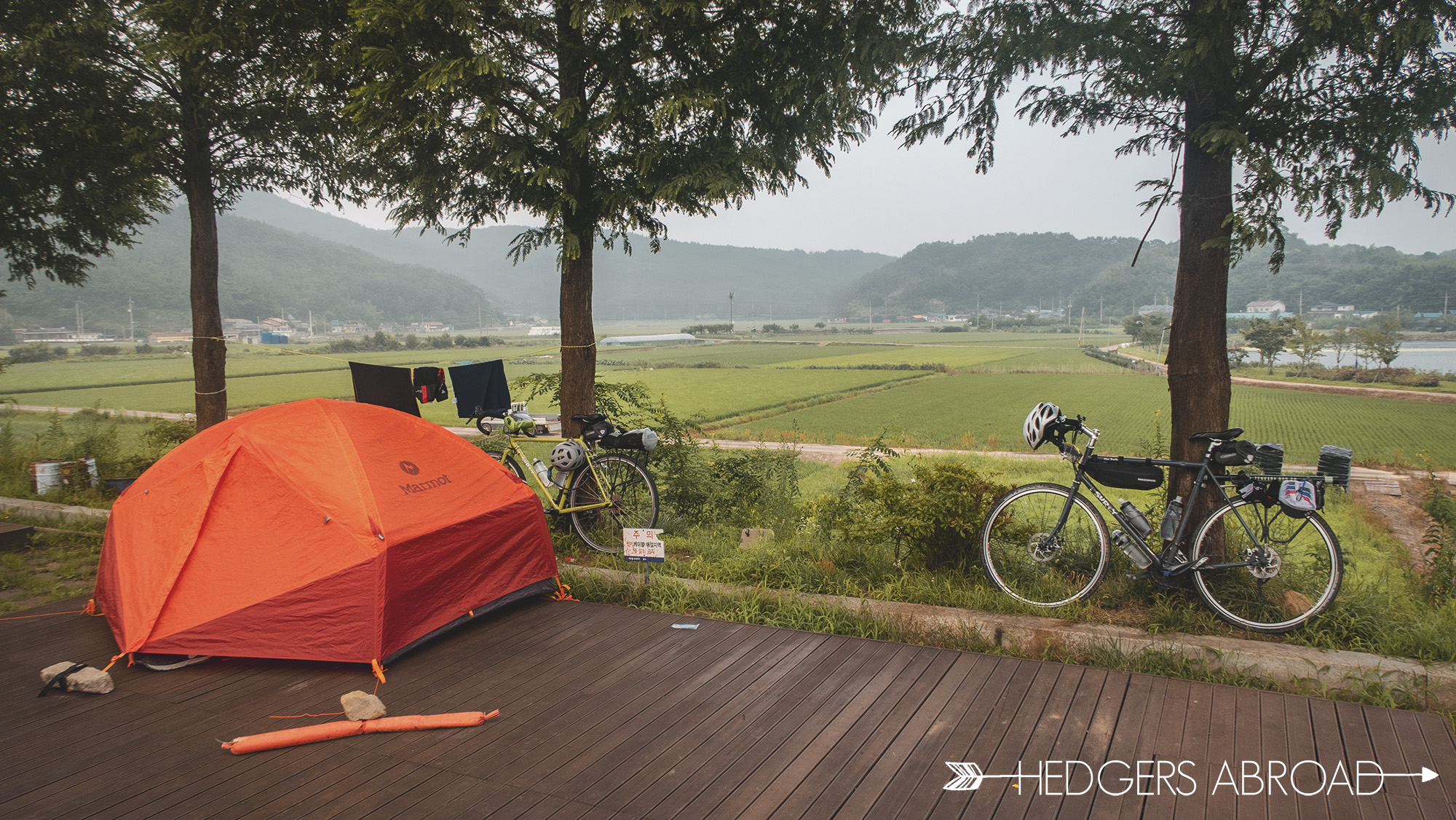
The beach is best for lounging, as you can’t swim. Gwangyang is famous for its shipping yard, so the water is actually quite deep and the beach can get muddy at low tide. We decided that heading to our campsite would be best as they have showers, a fishing pond, and equipment for you to borrow if you want to try your hand at clam digging in the mud flats! After a brief argument about which camping platform belonged to whom with our neighbors, we decided to make up in typical Korean fashion. They welcomed us to join them in their BBQ dinner and soju and we gladly accepted. For a couple of hours in both English and Korean, we talked about everything from the education system to their families, from our nearly seven years in Korea to our cycling trip down the Seomjingang River. It was a perfect way to end the first half of our trip. Ryan caught no fish, but was excited to try his new tenkara rod.
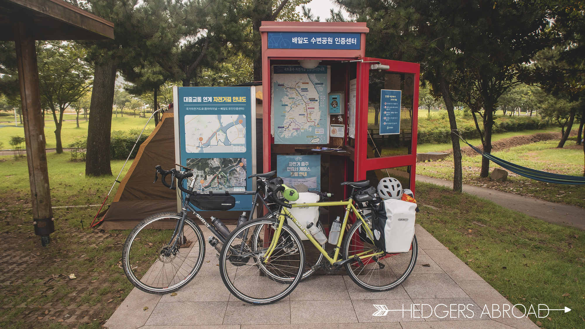
The end of the trail in Gwangyang and the last stamp booth
Day 4
고포수변공원캠핑장 Campsite – Hwagae
43km
We got up early in the morning and enjoyed our first visible sunrise of the trip! We didn’t take a ton of gear for camping, so getting ready was fairly simple. Waving goodbye to our new friends, we hopped on our bikes and turned north. Ryan’s bike had thus far done a decent job of holding up after the accident, but his gears were randomly jumping and his front tire needed to be trued. That would have to wait for us to return back home, however, as no bike shops were located along the route.
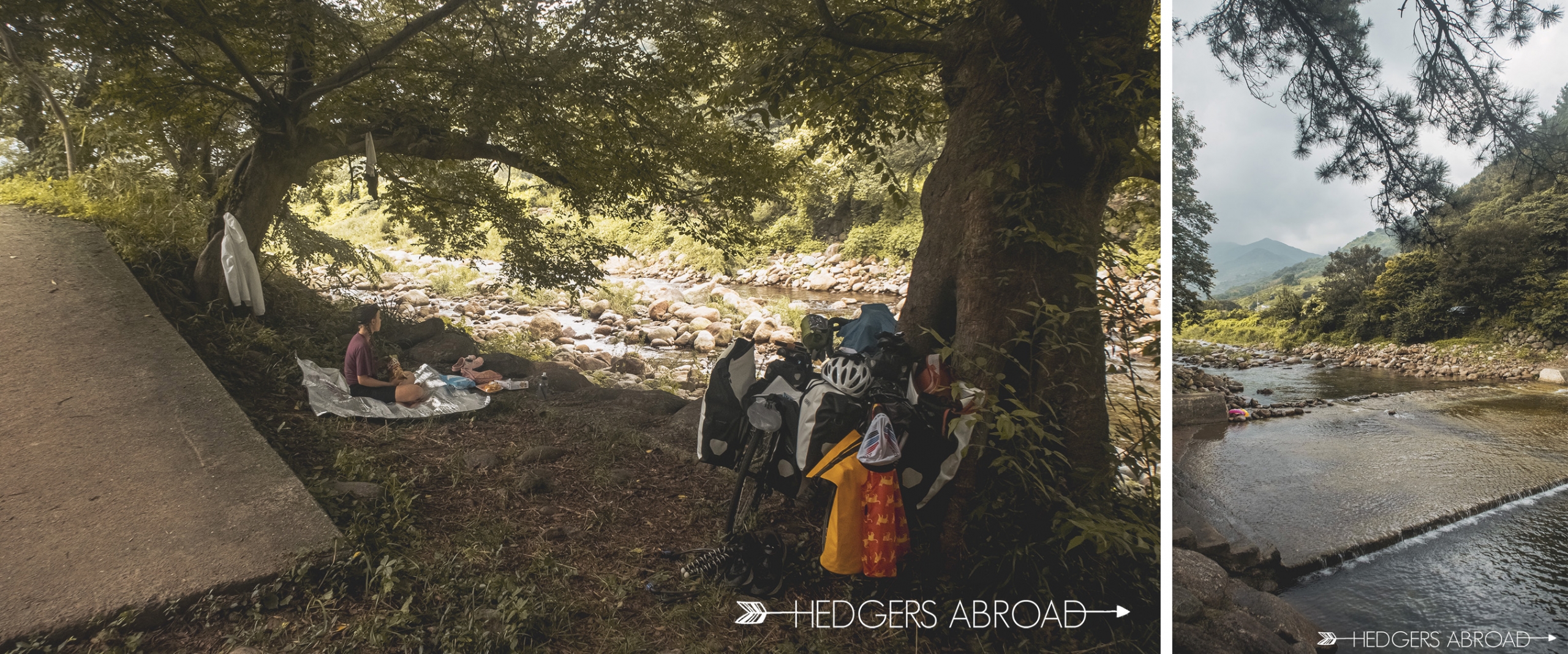
Outside of the Gwangyang shipping yard
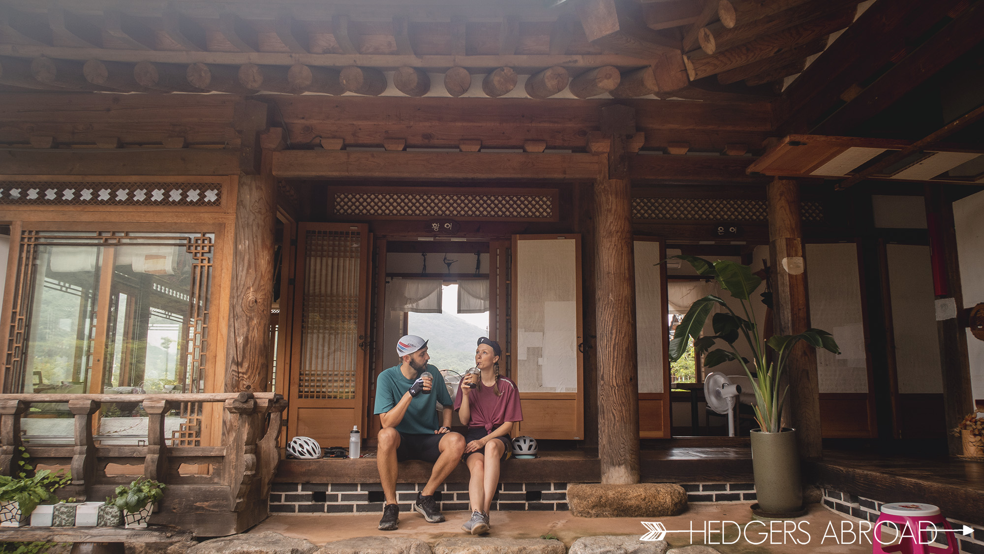
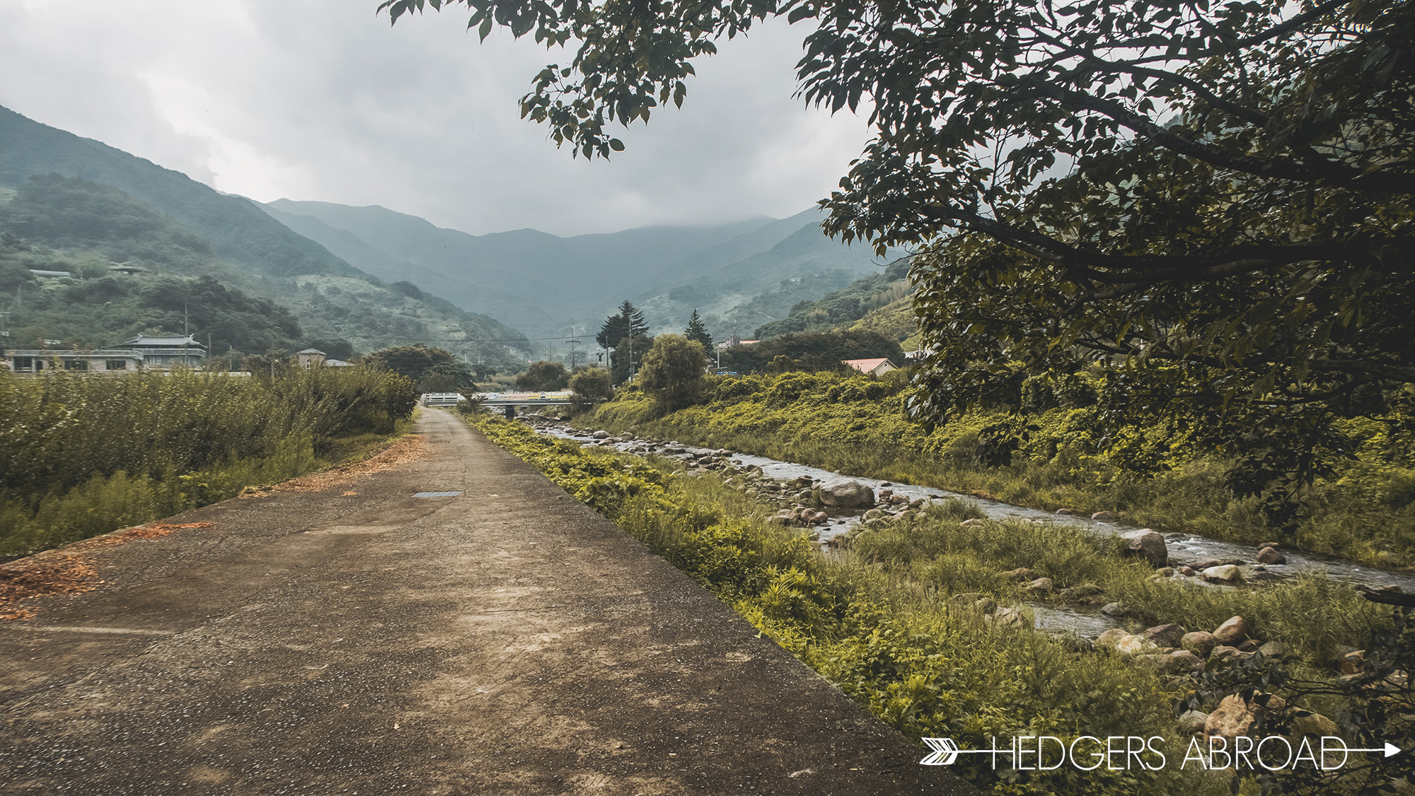
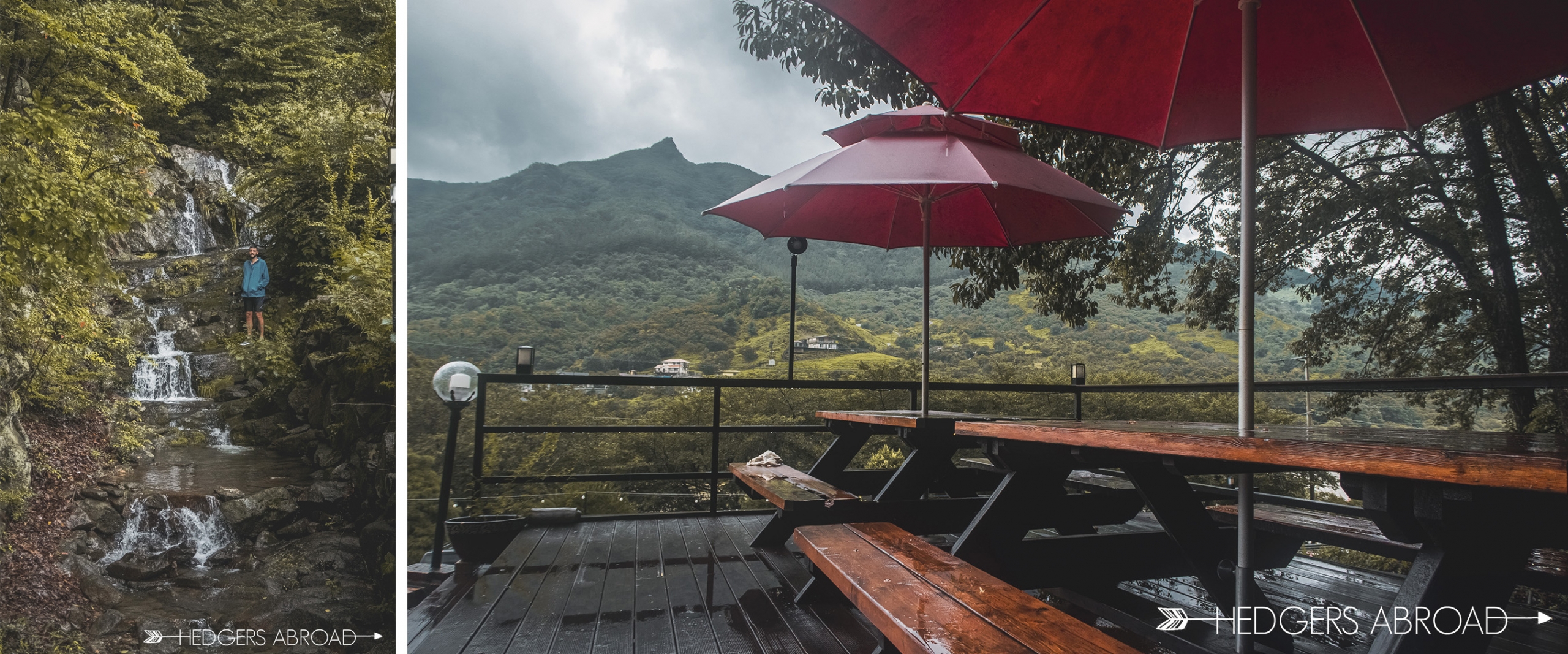
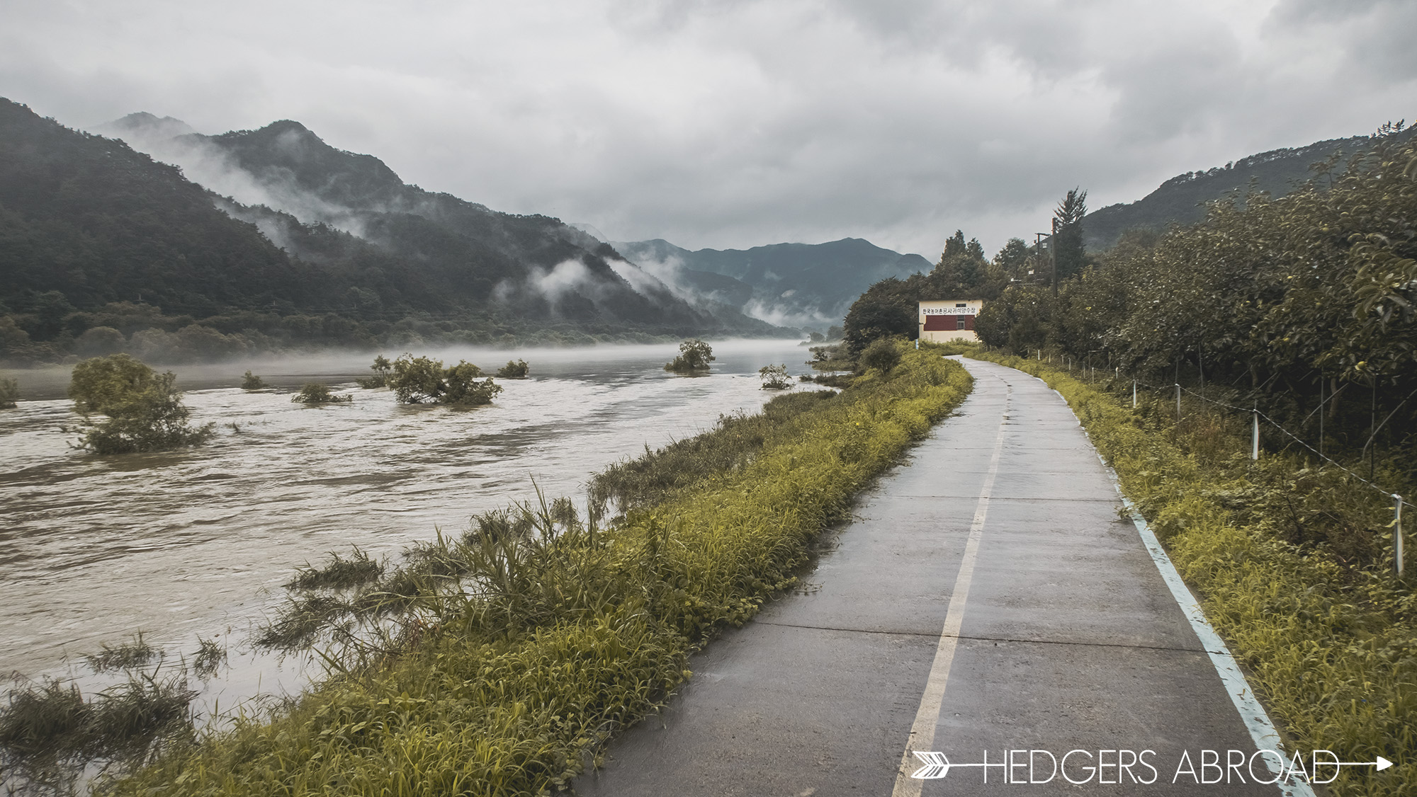
Heading north means we were heading back into the mountains, uphill, and likely towards more rain. We decided to stop for a picnic in the Geumcheon Valley (금천계곡) outside of Hwagae, which is quite picturesque. The waters are cool and you can swim and enjoy the shaded riverside. Our time was cut short when the rains started to pour down once more. We rushed to put the gear back together in our waterproof panniers and pushed the rest of the 6 kilometers back into Hwagae. The rains weren’t letting up and the constant drizzle drove us to our hotel earlier than we expected. Upon seeing us soaking wet, the owner was gracious enough to allow us to check in a couple of hours early. We washed our clothes, snacked in the cafe overlooking the mountains, and then watched some TV for the remainder of the evening. We were keeping an eye on the weather as the rains were pushing the river levels higher and higher. It became clear that our trip was in limbo and that we’d need to keep a close watch on radar.
The exact same spot, two days apart
We debated stopping our trip early and finding public transit back to our car, but thought we could push through the next two days. We had no idea what was in store for the Seomjin River within the next forty-eight hours. In that time, the peaceful valley of the Hwagae village, as well as the other cities as villages along the river, would be nearly completely covered in flood waters upwards of 20 meters (65 feet).
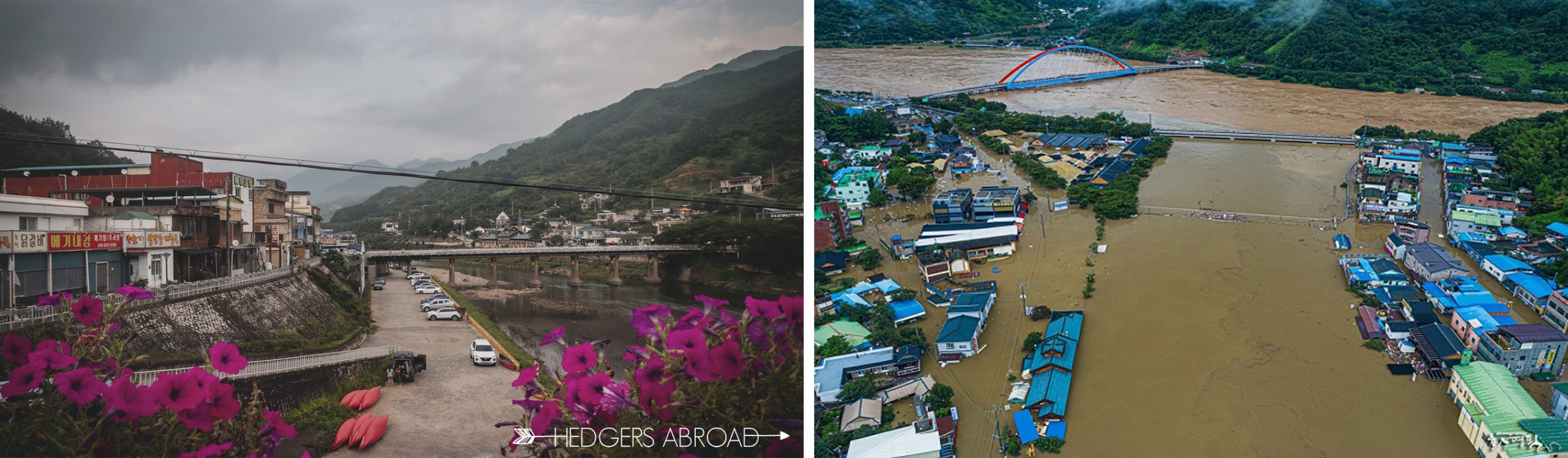
The exact same spot, two days apart… The bridge in the first picture, completely underwater
Day 5
Hwagae – Gokseong
52km
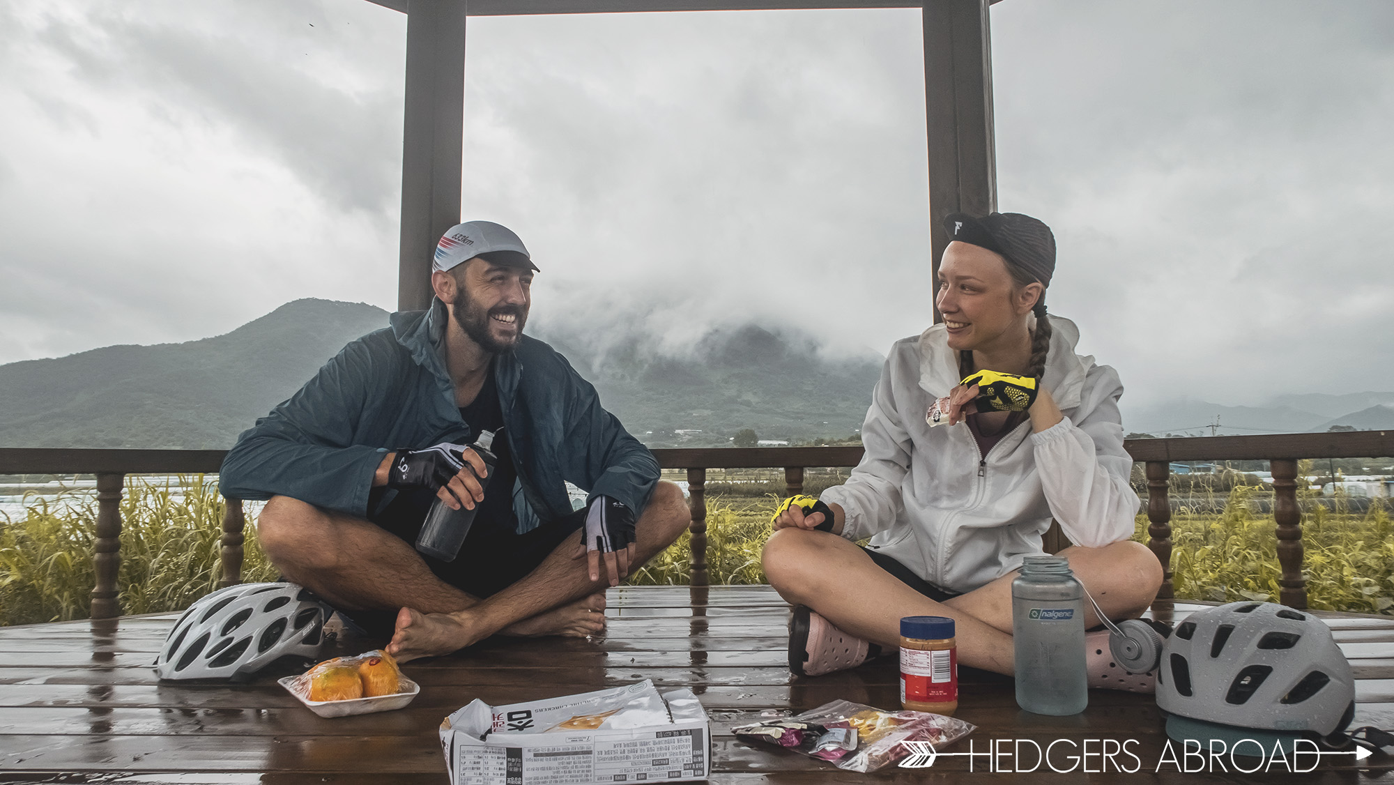
When we woke up, the rains had stopped and the morning was wet, yet beautiful. The forecast still said that the rains were still only scheduled to hit Seoul, which was 260km north of us. The capital had been hit hard and floods had caused a lot of damage to the city, roads, and many homes. Thinking we were free and clear, we set out for our penultimate day of cycling. Three kilometers in, however, the sky opened up and dumped on us harder than it had the entire trip. We stopped at a cafe, grateful that the owner was there that early in the morning and willing to make us some coffee. Again, the rains lessened and off we went; north. For the rest of the day we were rained on, but nothing extremely heavy.
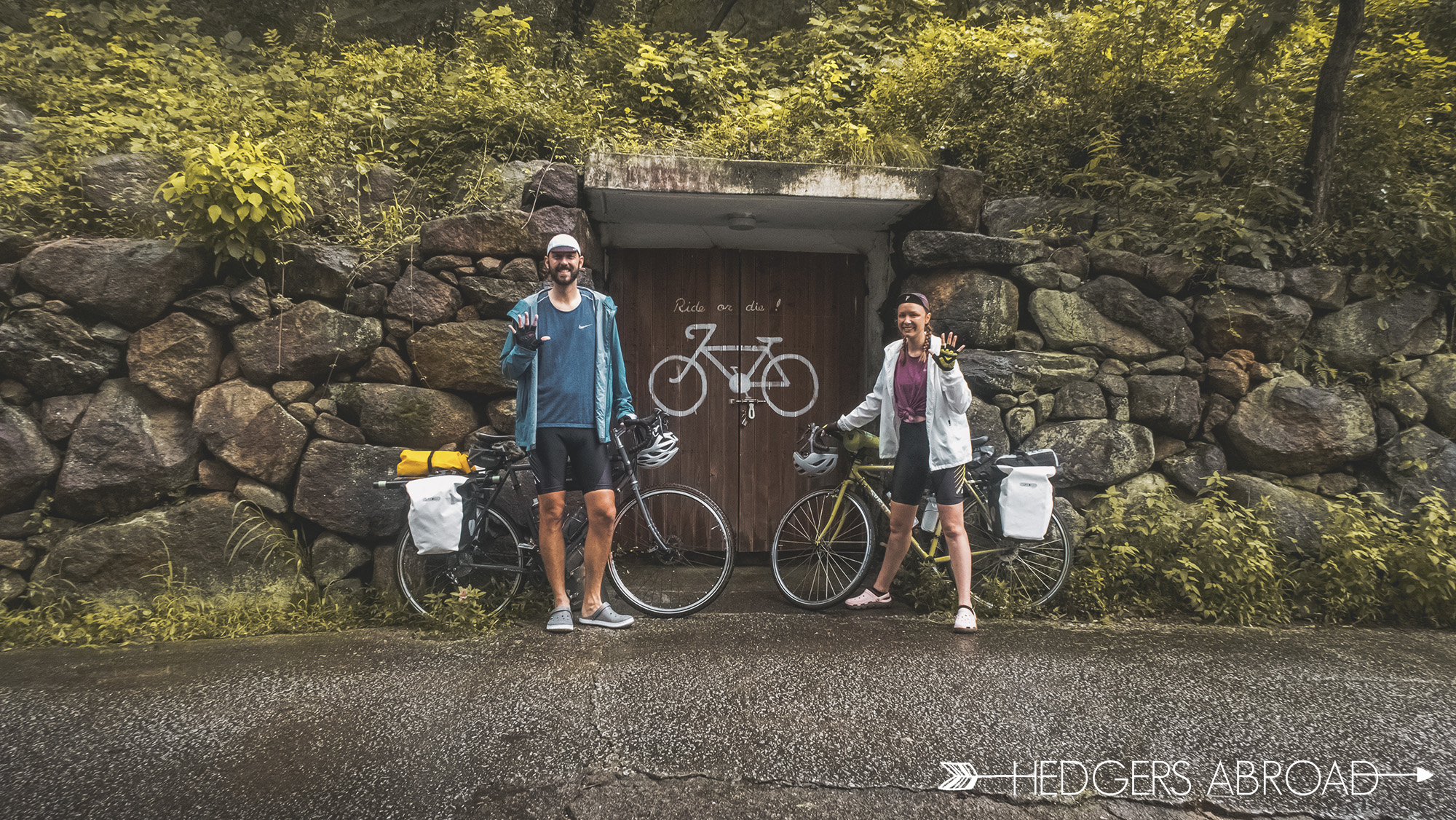
The area surrounding the Hoonie Hotel and their bike storage area they created!
This section of the road was uphill almost the entire way after Gurye, but since it is on nicely paved roads, the going is really easy and we were able to keep up an average of 22 kilometers per hour. We stopped a couple of times into the pagodas for snacks and one longer stop at the Gokseong Train Village for some lunch. There actually weren’t many restaurants to choose from, so we considered ourselves lucky when we got to enjoy some baekban, an entire meal of side dishes, at a small hole-in-the-wall place overlooking the river. The river, at this point, looked about the same as it had when we passed through three days ago and we were encouraged about finishing our first touring experience.
Wet and tired, but still having a really good time… Also, highly recommend crocs in the rain
Day 6
Gokseong – Gangjinmyeon Sports Park
55 km
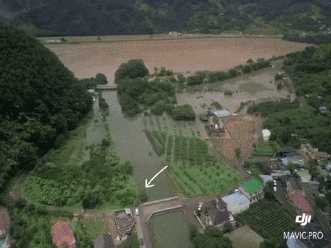
This morning was gorgeous and the rains had subsided throughout the entire night. The river looked so peaceful with the fogs rolling in over the mountains. We posed for our final day picture on a bridge right outside our hotel, overlooking the river. We had no way of knowing that in just a few short hours, this bridge would be completely underwater, and the bike trail embankment next to it would be completely eroded, flooding the entire surrounding villages, farmland, and city of Gokseong. It is so surreal to see the footage of this spot played on the news over and over.
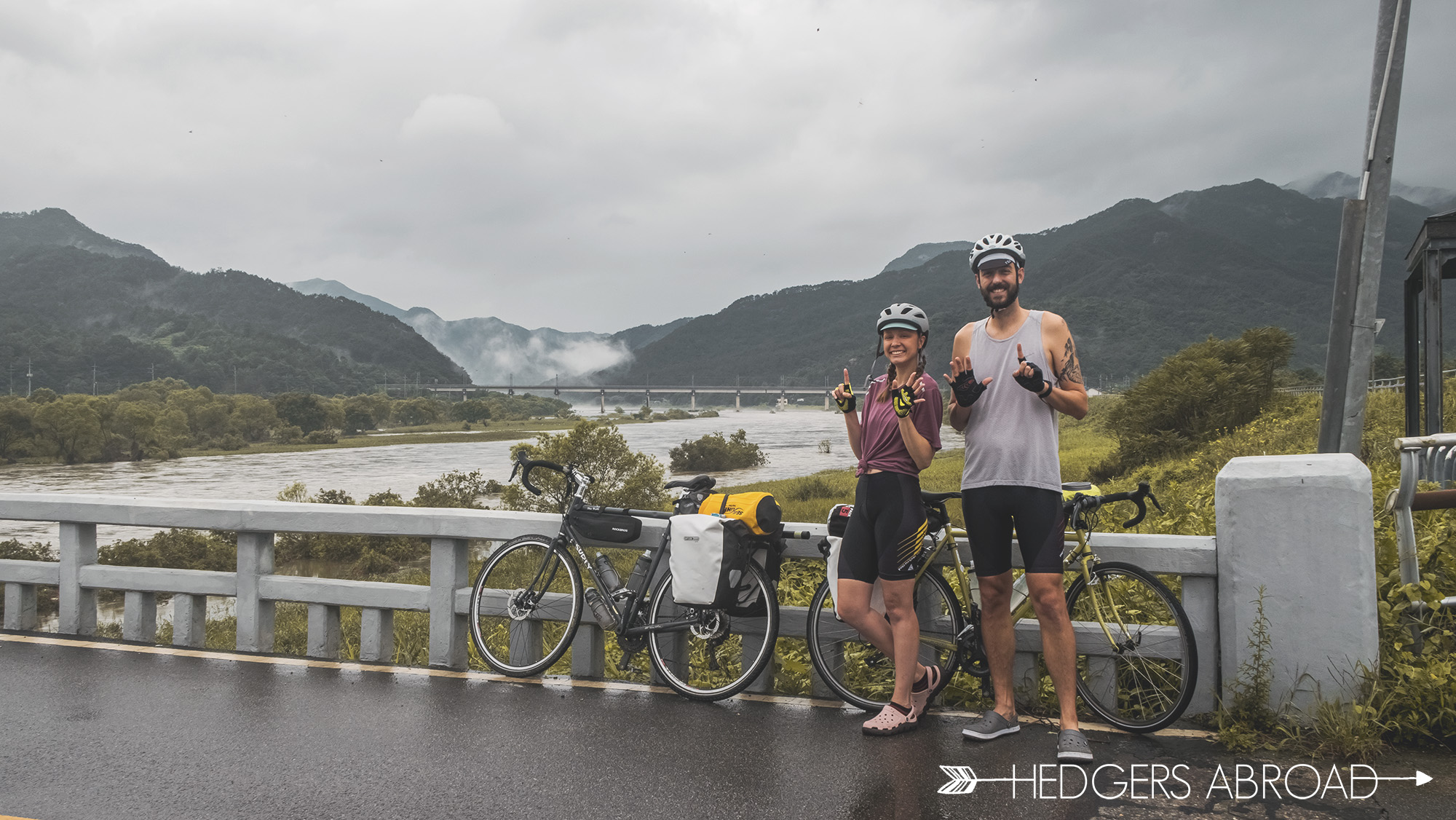
The exact same spot as the photo above, hours apart… Bike trail completely gone
Remarkably, half of our route on this final day was without any rain. The ride was easier than the first time we had come through, perhaps because we were doing a better job of snacking and keeping our energy stores up. A late morning pit stop for ramen and kimchi also helped, I’m sure! After that snack and hitting the trail once more, the sky really opened up on us and the rains coming down were torrential and relentless. We had more than thirty kilometers still to go, as we were certain we’d need to detour again due to high river levels covering the same two low lying bridges. We put our heads down and knocked out the remaining distance as fast as we could. The detour through the mountain village was once again necessary, but we knew we were close to the finish line. We learned once and for all that there’s no shame in pushing your bike up a hill.
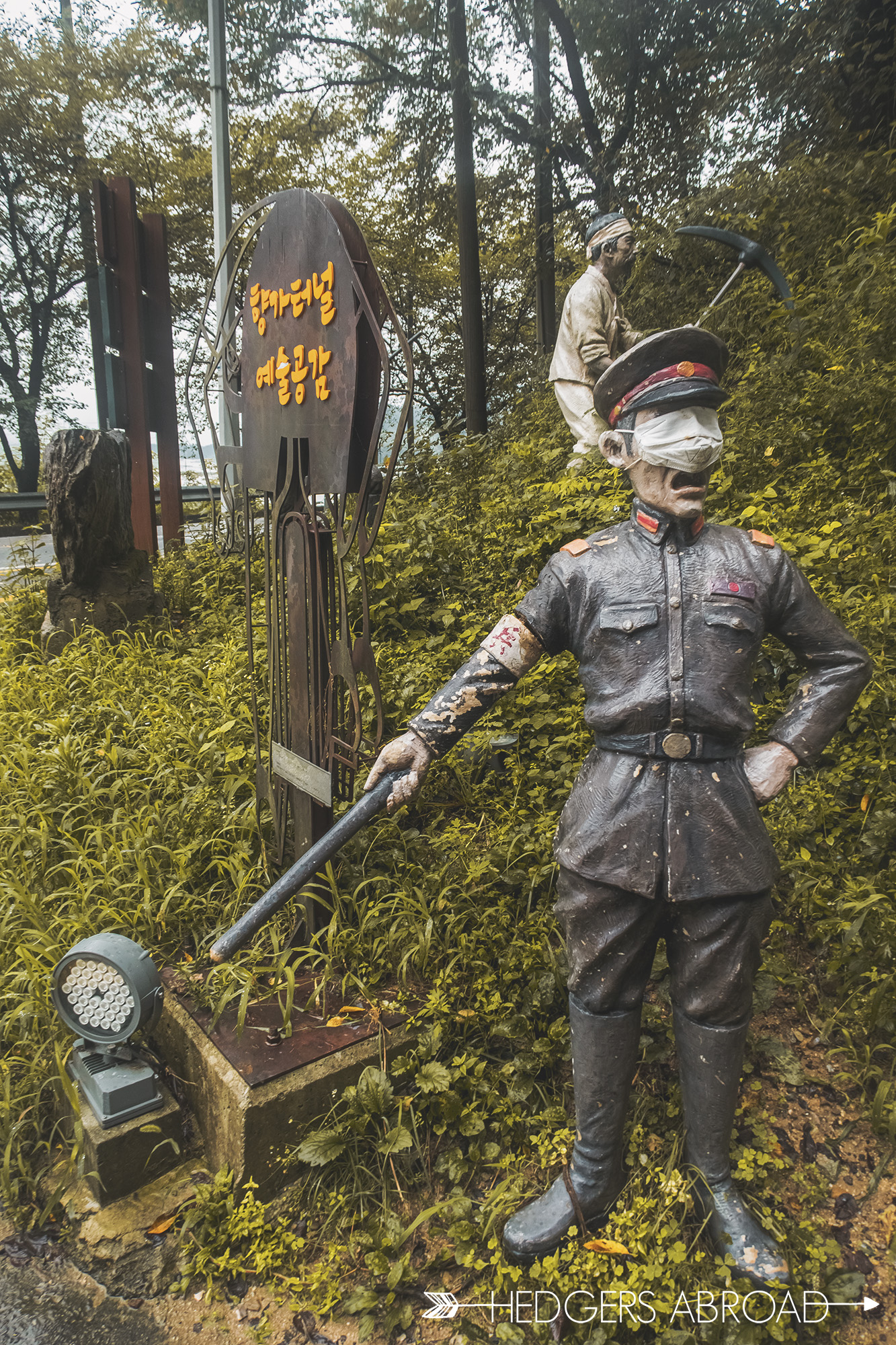

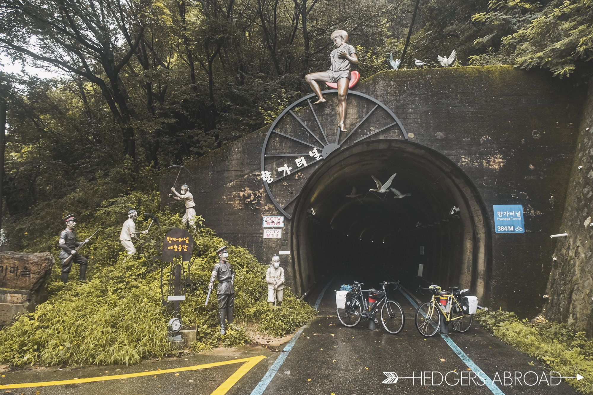
Tunnel built by Korean slave labor during the Japanese Occupation…Love the eye mask on the Japanese general
The final 15km (10miles) were wet and full of “I think we’re almost there!” moments. An emergency vehicle passed us ominously, then passed us again later, honking and waving, clearly warning us to get out of the area. The village loudspeakers warned people to stay off the mountains and not to go check on farms for flooding. Thankfully, we were close to the finish. Back at our car, the rains came down harder than ever and our poor raincoats couldn’t keep us dry anymore. We threw everything hastily into the car and changed at a nearby gas station bathroom into drier clothes before attempting to find a restaurant nearby for a hasty lunch. As we ate our meal greedily, the restaurant owners stared nervously at the river across the street. Ryan looked at me, half finished with his food and said, “We need to go. Now.” We paid quickly and left as soon as possible, driving away from the river, the village, and the rising water.
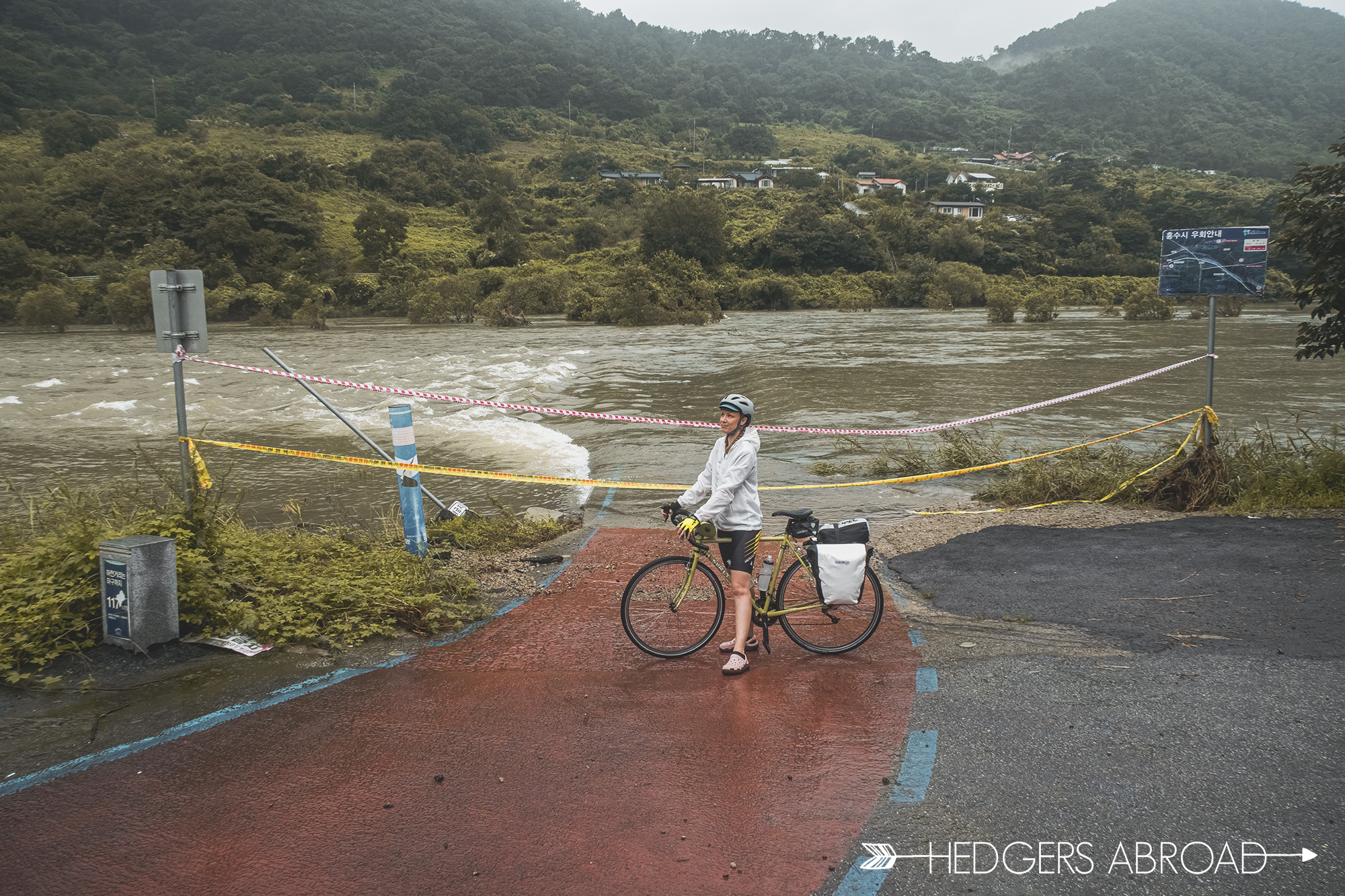
One of the closed low bridges
The Aftermath
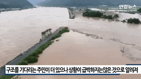
When we got back home to Naju, in our apartment next to the Yeongsan River, we noticed how high it was as well. Turning on the news, our stomachs sank when images of the flooding Seomjin River lit up our TV. The storm system scheduled to solely hit Seoul, had stopped and unloaded on the already high waters of the Seomjin River. The dams, some of which were controlled by the leaders of the villages, had not been managed properly and the too late release of water resulted in catastrophe.
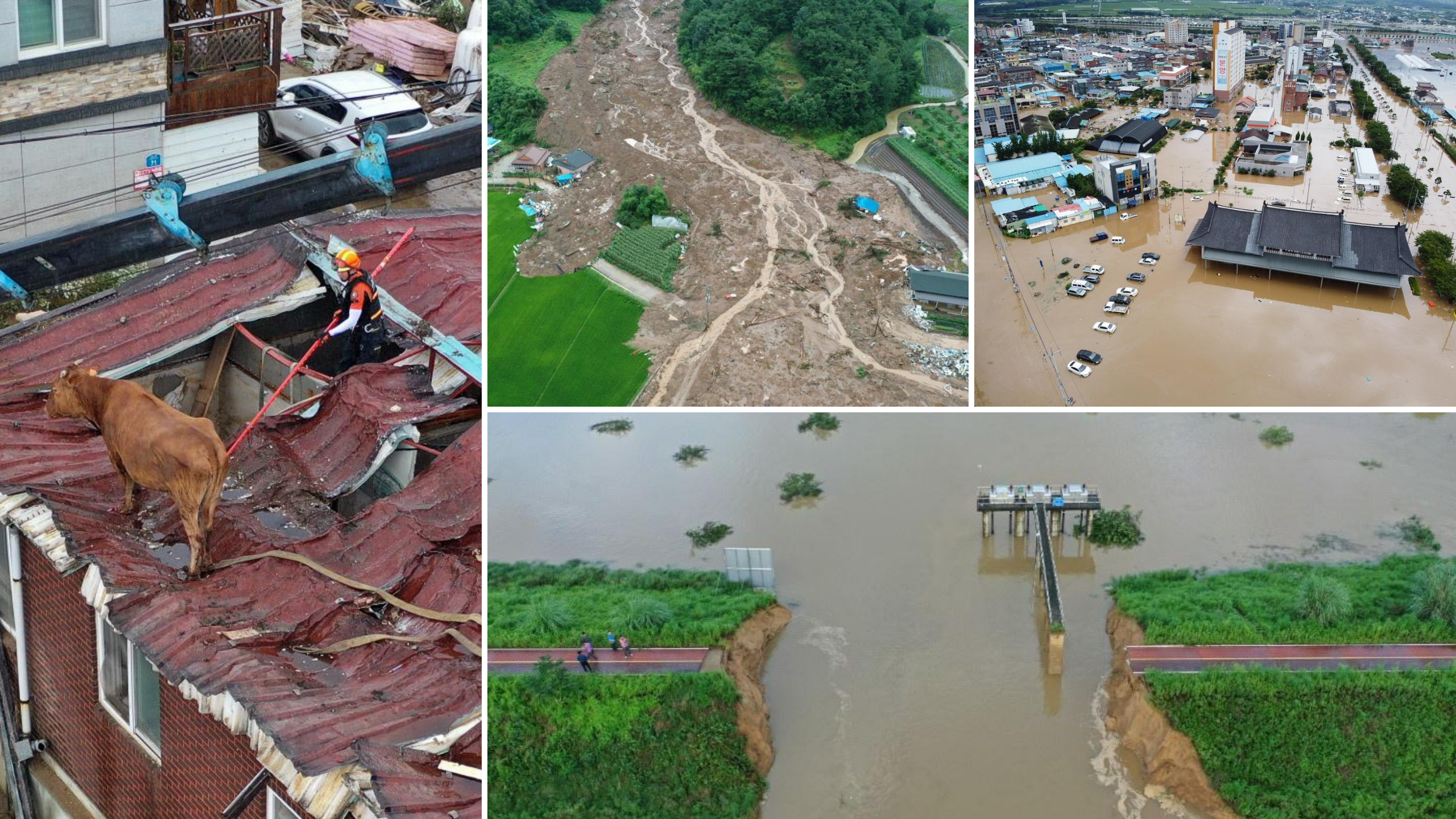
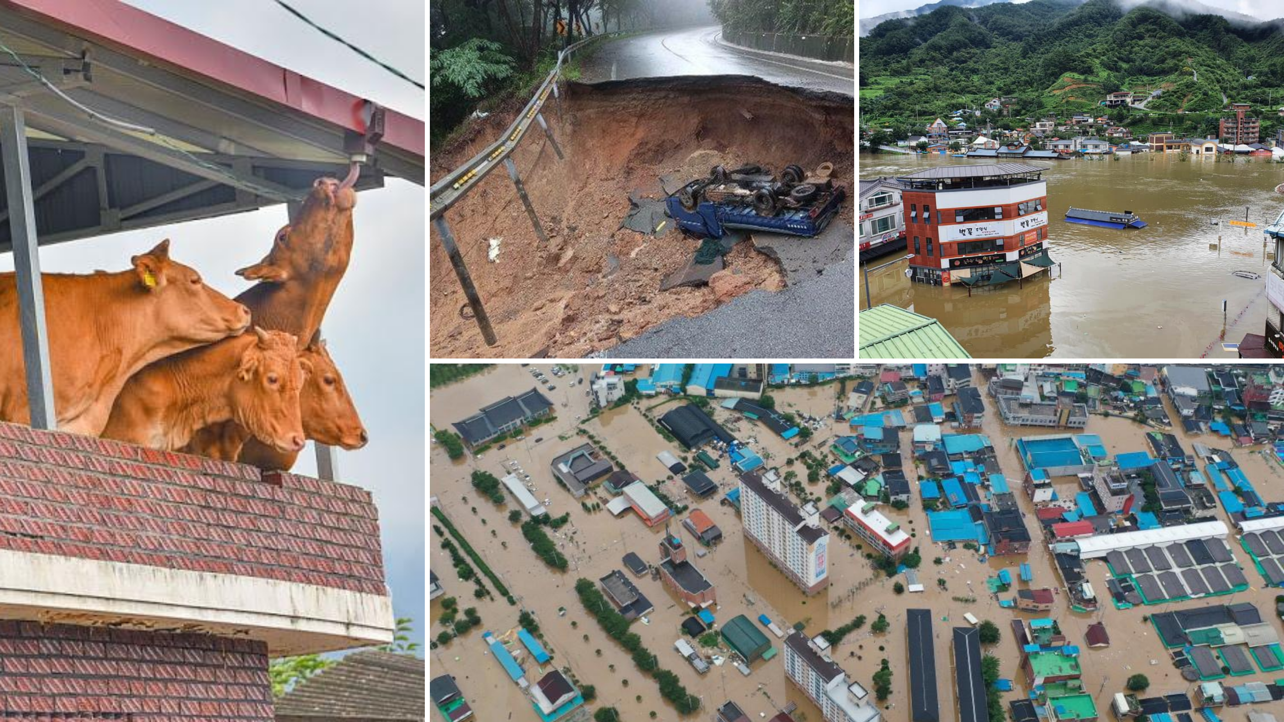
We will share photos of our river’s flood in a following post, but for now, please look at these images and think about the people who are suffering. Ryan has several students from Gurye and along the Seomjin River who lost their entire homes. There are still 11 people missing and 31 have died in this flood alone. Nationwide there has been flooding, landslides, houses collapsing, and people missing and dead. Please, keep South Korea in your thoughts as we recover from not only a pandemic, but now this massive destruction. “Korean Monsoon Season 2020- Couldn’t you have picked a different year?”
Seomjin River Cycling Maps
We’ve compiled some maps showing not only our route, but also some of the places of interest along the river. Regardless of if you are planning to cycle the 155 kilometer trail, or just want to relax along the river in a pension or campsite, these maps can help you plan your trip!
-

- Day 1
-
- Day 2
-
- Day 3
-
- Day 3

Wow, I didn’t expect this post to bring so many memories from my own summer trip around Korea. Glad you guys made it home safely – can’t wait to read more of your adventures! (Ended up here because I plan to hike Seoraksan next month and your winter hiking story came up on my Google search…). Stay safe!
Looks awesome! I’ve definitely got to try that now that the summer heat has gone. Those maps will be really useful, too 🙂
My sister and brother-in-law are planning to do this route next summer! Thank you for such a comprehensive guide, can’t wait to share this with them 😀
Nice looking pics agnes nice story
What sites do you use to find rooms?.
We can’t read korean.
Thanks